Category:NASA MODIS images of islands
Jump to navigation
Jump to search
Media in category "NASA MODIS images of islands"
The following 118 files are in this category, out of 118 total.
-
 A68A nears South Georgia.jpg 1,658 × 1,658; 505 KB
-
 Akan volcano meakan-dake hokkaido japan space shot.jpg 928 × 780; 209 KB
-
 Aleutian wave clouds 29 September 2016.png 8,081 × 4,753; 11.71 MB
-
 Alex 2016-01-14 1530Z.jpg 2,224 × 1,696; 752 KB
-
 Amami Islands NASA.jpg 850 × 802; 48 KB
-
 Azores satellite photo-NASA.jpg 1,600 × 1,200; 99 KB
-
 Baffin MODIS 2016187.jpg 5,500 × 5,500; 8.17 MB
-
 Bahamabank-1.jpg 564 × 642; 253 KB
-
 Bahamabank-2.jpg 564 × 642; 295 KB
-
 Bahamabank.jpg 564 × 642; 125 KB
-
 Bahamas.A2004024.1600.250m Grand Bahama crop.jpg 541 × 190; 15 KB
-
 Banc du Geyser Panorama MODIS.jpg 1,200 × 763; 170 KB
-
 Bermuda.jpg 220 × 180; 4 KB
-
 Canarias NASA2.jpg 1,024 × 714; 100 KB
-
 Canary A2002186 1155 250m.jpg 3,400 × 4,400; 1.89 MB
-
 Cape Verde islands 250m.jpg 4,000 × 3,000; 207 KB
-
 Cape Verde islands resized.jpg 2,168 × 1,626; 579 KB
-
 Cape Verde, Kármán vortex street.jpg 2,428 × 1,619; 3.46 MB
-
 CapeVerde.A2002360.1210.250m.jpg 2,800 × 3,600; 485 KB
-
 Chaunskaya Bay (MODIS on June 5 2001).jpg 900 × 900; 123 KB
-
 Chubu Region Japan 2003.png 1,480 × 1,923; 4.03 MB
-
 Chugoku Region Japan 2018.png 1,440 × 1,147; 1.89 MB
-
 Cloud Patterns Over the Prince Edward Islands.jpg 2,400 × 3,200; 954 KB
-
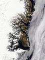
 Cloud streets Around Southern Greenland (6965046589).jpg 8,000 × 6,200; 8.19 MB
-
 Cuyo Islands - Satellite image of Philippines in March 2002.jpg 4,600 × 6,000; 2.87 MB
-
 Disko Island MODIS.jpg 1,150 × 726; 165 KB
-
 Dust Plumes off Western Africa.jpg 5,600 × 7,200; 3.24 MB
-
 Eastern Lesser Antilles (Barbuda to Grenada) satellite image.jpg 2,400 × 3,200; 1.1 MB
-
 El Hierro eruption MODIS 20111013.jpg 434 × 278; 67 KB
-
 El Hierro eruption MODIS 20111023.jpg 872 × 764; 231 KB
-
 El Hierro Submarine Eruption - NASA Earth Observatory.jpg 720 × 480; 141 KB
-
 Ellesmere MODIS 2016169.jpg 2,880 × 4,000; 3 MB
-
 Eruption of Kuchinoerabu-jima 2015.jpg 600 × 400; 29 KB
-
 Eruption on Isla Fernandina.jpg 2,600 × 2,000; 667 KB
-
 Ev11558 Reunion.A2002016.0635.721.250m.jpg 2,000 × 1,500; 288 KB
-
 Ev11558 Reunion.A2002018.0620.721.250m.jpg 2,000 × 1,500; 550 KB
-
 Fires Sweep Through Madeira - 2013-08-19.jpg 1,156 × 772; 38 KB
-
 Fogo eruption 2014.jpg 720 × 540; 105 KB
-
 Galapagos-satellite-2002.jpg 1,600 × 1,200; 387 KB
-
 Galapagos-Sierra Negra 2005 October 22.jpg 1,776 × 1,776; 1.47 MB
-
 Greenland.A2003233.1340.250m.jpg 2,400 × 3,200; 1.85 MB
-
 Gunung Merapi 2006-05-14, MODIS.jpg 4,448 × 3,336; 3.01 MB
-
 Hawaje-NoRedLine.jpg 3,600 × 2,800; 2.81 MB
-
 Heard Island 2005-08.jpg 2,000 × 1,600; 850 KB
-
 Ito Ignimbrite Aira Caldera Kyushu Japan.jpg 1,630 × 1,446; 444 KB
-
 JanMayen angepasst.jpg 440 × 340; 9 KB
-
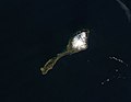 JanMayen.jpg 440 × 340; 5 KB
-
 Kansai Region Japan 2003.png 1,028 × 1,113; 1.6 MB
-
 Kanto Region Japan 2003.png 1,134 × 1,232; 1.81 MB
-
 Karthala MODIS 20051125.jpg 1,600 × 1,200; 298 KB
-
 Kazan-retto.jpg 1,000 × 657; 69 KB
-
 Kerguelen.jpg 721 × 741; 260 KB
-
 Kolguyev MODIS 2016233.jpg 1,024 × 1,024; 99 KB
-
 Kyushu-Japan Terra2002145.jpg 2,000 × 2,500; 368 KB
-
 Lakshadweep Islands - NASA Earth Observatory.jpg 720 × 720; 17 KB
-
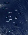 Lakshadweep.jpg 498 × 630; 41 KB
-
 Lesser Antilles 250m (cropped to Dominica Passage).jpg 600 × 600; 165 KB
-
 Lesser Antilles 250m (cropped to Martinique Passage).jpg 600 × 600; 168 KB
-
 Lesser Antilles 250m.jpg 838 × 1,120; 424 KB
-
 Lesser Sunda Islands, Indonesia (4632905990).jpg 4,400 × 3,400; 1.64 MB
-
 LesserSundaIslands A2003077 0210 250m.jpg 4,800 × 3,600; 2.12 MB
-
 Madeira AMO 2010225 lrg.jpg 1,000 × 1,200; 442 KB
-
 Madeira amo 2012201 lrg.jpg 912 × 684; 61 KB
-
 MadeiraIslands.A2003210.1205.250m.jpg 800 × 600; 29 KB
-
 Maldives.A2004005.0545.1km.jpg 700 × 900; 153 KB
-
 Nagano, Japan 1998 (12350251945).jpg 4,800 × 6,000; 3.75 MB
-
 Nansei Island Bathymetry MODIS 2004.jpg 5,000 × 4,000; 708 KB
-
 Nansei Island MODIS 2004.jpg 5,000 × 4,000; 729 KB
-
 Nansei-Islands-Japan-23-May-2019-NASA.png 6,115 × 3,881; 20.02 MB
-
 Nettilling Lake (December 10, 2013).jpg 1,133 × 691; 251 KB
-
 Nevis Satellite.jpg 576 × 580; 154 KB
-
 NewZealand.A2002296.2220.250m North Island crop.jpg 2,380 × 3,368; 1,008 KB
-
 Noord-Madagascar.jpg 2,500 × 3,129; 1.13 MB
-
 Ogasawara Gunto MODIS.jpg 1,000 × 634; 200 KB
-
 Okinawa Islands NASA.jpg 800 × 600; 39 KB
-
 Osumi Islands.jpg 500 × 350; 12 KB
-
 Paracel Islands Panorama labelled.jpg 1,028 × 728; 217 KB
-
 Phytoplankton Bloom off Greenland.jpg 2,400 × 3,200; 627 KB
-
 Ryukyu Islands on February 19, 2017.jpg 2,400 × 3,200; 637 KB
-
 Saharan dust - Jun 18, 2020.jpg 4,532 × 3,233; 1.66 MB
-
 Sakishima Islands.jpg 1,500 × 1,000; 142 KB
-
 Satellite image of Antigua And Barbuda in September 2002.jpg 311 × 372; 16 KB
-
 Satellite image of Barbados September 2002.jpg 128 × 144; 4 KB
-
 Satellite image of Cape Verde in December 2002.jpg 1,189 × 1,111; 485 KB
-
 Satellite image of Dominica in September 2002.jpg 118 × 210; 6 KB
-
 Satellite image of Grenada in September 2002.jpg 202 × 268; 13 KB
-
 Satellite image of Hokkaido, Japan in January 2003.jpg 2,200 × 2,800; 1.74 MB
-
 Satellite image of Hokkaido, Japan in May 2001.jpg 2,400 × 3,200; 466 KB
-
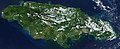 Satellite image of Jamaica in November 2001.jpg 949 × 387; 65 KB
-
 Satellite image of Japan in April 2018.png 6,000 × 6,600; 19.44 MB
-
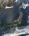 Satellite image of Japan in May 2003.jpg 5,800 × 7,200; 3.69 MB
-
 Satellite image of Maldives in December 2002.jpg 597 × 2,255; 196 KB
-
 Satellite image of Philippines in March 2002.jpg 4,600 × 6,000; 3.58 MB
-
 Satellite image of The Azores in May 2003.jpg 1,374 × 996; 46 KB
-
 Satellite view of Japan in April 2018.jpg 6,000 × 6,600; 1.65 MB
-
 Scoresby Sund 2003-08-21 Terra MODIS.jpg 1,832 × 1,640; 1.38 MB
-
 Scoresby Sund image satellite.jpg 2,545 × 1,969; 950 KB
-
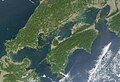 Seto Inland Sea satellite.jpg 1,024 × 696; 242 KB
-
 Southern Greenland (8341574635).jpg 2,600 × 1,800; 947 KB
-
 Spring Bloom Colors the Pacific Near Hokkaido.jpg 7,555 × 9,212; 10.23 MB
-
 Sumatra fires Oct 2006.jpg 4,000 × 4,000; 1.98 MB
-
 Summer thunderstorm clouds over Japan.jpg 3,600 × 1,450; 751 KB
-
 SundaIslands.A2003242.0225.500m.jpg 2,200 × 1,700; 600 KB
-
 Taiwan NASA Terra MODIS 23791.jpg 1,200 × 1,600; 314 KB
-
 Terceira Azores MODIS Pict.gif 758 × 582; 199 KB
-
 Terra Kyushu 20091028.jpg 1,619 × 1,748; 1.47 MB
-
 Tohoku Region Japan 2003.png 1,668 × 2,193; 2.74 MB
-
 TristanDaCunha.jpg 440 × 340; 3 KB
-
 Varied Ice Shapes along the Greenland Coast 2010-03-27 lrg.jpg 5,200 × 6,800; 3.6 MB
-
 Varied Ice Shapes along the Greenland Coast 2010-03-27.jpg 720 × 480; 99 KB
-
 Vaygach MODIS 2016225.jpg 1,000 × 1,200; 143 KB
-

-
 Vortex street near Madeira Island, Dec 1, 2002.jpg 2,800 × 2,200; 1.35 MB
-
 Wave cloud.jpg 1,919 × 1,215; 544 KB
-
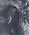
 Wave Clouds from South Sandwich Islands.jpg 2,000 × 2,600; 563 KB
-
 Wrangel-island-sat.jpg 929 × 563; 370 KB
-
 Wrangelisland (cropped).jpg 2,710 × 2,035; 820 KB
-
 Wrangelisland.jpg 4,000 × 3,000; 1.55 MB


.jpg)


.jpg)


_satellite_image.jpg)


.jpg)
.jpg)

.jpg)


.jpg)


.jpg)


.jpg)


.jpg)
