Category:Mont Thabor (France)
Jump to navigation
Jump to search
| Object location | | View all coordinates using: OpenStreetMap |
|---|
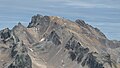
mountain of the Cottian Alps  Le mont Thabor vu depuis le pic du Thabor au nord. | |||||
| Upload media | |||||
| Instance of | |||||
|---|---|---|---|---|---|
| Location |
| ||||
| Mountain range | |||||
| Topographic prominence |
| ||||
| Elevation above sea level |
| ||||
| Different from | |||||
 | |||||
Subcategories
This category has only the following subcategory.
Media in category "Mont Thabor (France)"
The following 21 files are in this category, out of 21 total.
-
 Ascension du Mont Thabor en raquettes.JPG 4,608 × 3,456; 3.32 MB
-
 Ascension du mont Thabor.jpg 1,920 × 1,440; 603 KB
-
 Ascension du Mt Thabor.jpg 1,920 × 1,440; 599 KB
-
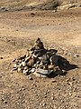 Cairn-01.jpg 3,024 × 4,032; 6.63 MB
-
 Col de Valmeinier, près du Mont Thabor.jpg 6,000 × 4,000; 10.76 MB
-
 Depuis le mont Thabor.jpg 4,912 × 1,080; 2.75 MB
-
 Depuis le Mont Thabor.jpg 4,560 × 1,080; 2.29 MB
-
 Environs du Mont Thabor.jpg 4,608 × 2,592; 5.34 MB
-

-
 Il monte Thabor visto dal Pic du Lac Blanc.jpg 5,184 × 2,920; 8.14 MB
-
 Les rois mages (près du Mont Thabor).jpg 3,160 × 1,080; 1.87 MB
-
 Mont Thabor and Pic de Thabor seen from Cime de Caron.jpg 6,016 × 4,000; 11.7 MB
-
 Mont Thabor.JPG 3,264 × 2,448; 3.83 MB
-
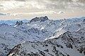
 Monte Thabor dal col de Valmenier.jpg 1,200 × 675; 568 KB
-
 Monte Thabor visto dal Pic du Thabor.jpg 4,896 × 3,672; 5.41 MB
-
 Névache et vallée de la Clarée, Haute Vallée, vue sur le Mont Thabor (19).jpg 5,184 × 3,888; 4.99 MB
-
 Poco prima della vetta - Flickr - -ErWin.jpg 4,500 × 3,000; 7.96 MB
-
 Thabor et lac Chavillon.JPG 3,223 × 6,583; 23.96 MB
-
 Vue de la Cime Caron, Val Thorens 02.tif 9,628 × 3,474; 85.54 MB
-
 Vue de la Cime Caron, Val Thorens 03.tif 10,569 × 2,886; 75.52 MB
-
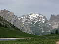
 Vue du mont Thabor et du pic du Thabor en Maurienne.jpg 770 × 512; 90 KB


,_Le_Granges_Serre_Con_Il_Monte_Thabor_Ed_Il_Gran_Seru%27_Sullo_Sfondo_38A51.jpg)


.jpg)


.jpg)
Categories:
- Alps of France
- Mountains of Savoie
- Cottian Alps
- Mountains of France by name
- Mountains of Hautes-Alpes
- Carboniferous conglomerate in Hautes-Alpes
- Carboniferous sandstone in Hautes-Alpes
- Carboniferous pelites in Hautes-Alpes
- Carboniferous shale in Hautes-Alpes
- Interbedded carboniferous limestone in Hautes-Alpes
- Stephanian
- Permian conglomerate in Hautes-Alpes
- Permian sandstone in Hautes-Alpes
- Permian pelites in Hautes-Alpes
- Permian shale in Hautes-Alpes
- Interbedded permian limestone in Hautes-Alpes
- Triassic quartzite in Hautes-Alpes
- Verrucano
- Rose quartz
- Coal seams in Hautes-Alpes
- Anthracite coal in France
- Carboniferous conglomerate in Savoie
- Carboniferous sandstone in Savoie
- Carboniferous pelites in Savoie
- Carboniferous shale in Savoie
- Interbedded carboniferous limestone in Savoie
- Permian conglomerate in Savoie
- Permian sandstone in Savoie
- Permian pelites in Savoie
- Permian shale in Savoie
- Interbedded permian limestone in Savoie
- Triassic quartzite in Savoie
- Coal seams in Savoie