Category:Mesocyclone and TVS on weather radar images
Jump to navigation
Jump to search
| Upload media | |||||
| |||||
Media in category "Mesocyclone and TVS on weather radar images"
The following 75 files are in this category, out of 75 total.
-
 03-31-2023 Wynne, AR - Munford, TN EF3.png 1,716 × 940; 1.58 MB
-
 05june-dow7-wide.gif 1,828 × 1,093; 32.26 MB
-
05june-dow7-wide2.ogv 7.5 s, 1,912 × 1,144; 42.35 MB
-
 05june-rapiddow-wide.gif 1,081 × 469; 42.63 MB
-
 05june-rapiddow-zoom.gif 1,914 × 552; 21.45 MB
-
 09-24-01 CollegeParkMD tor.PNG 1,000 × 750; 269 KB
-
 1735z 28 May 2008 radar Windsor, Colorado supercell.png 500 × 522; 413 KB
-
 2002 La Plata Tornado Radar.gif 481 × 875; 617 KB
-

-
 2024 Elkhorn Tornado on Velocity.jpg 1,080 × 1,131; 147 KB
-
 24OCT01IWXSRV01.gif 200 × 284; 633 KB
-
 3 24 2023 Amory Mississippi TVS.png 1,846 × 951; 781 KB
-
 Amory MS EF3 Tornado.png 1,716 × 940; 1.2 MB
-
 Bat-supercell encounter NWS.png 1,080 × 603; 35 KB
-
 Beauregard-Talbotton tornado radar loop.gif 1,052 × 732; 4.74 MB
-
 December 23, 2009 Longview, TX tornado radar loop.gif 603 × 470; 2.65 MB
-
 Deer Park Tornado Emergency V2.jpg 1,707 × 935; 315 KB
-
 Deer Park, TX EF3.png 1,716 × 940; 416 KB
-
 Denning tornado animation.gif 1,919 × 955; 2.65 MB
-
 EF3ConventLARadar.jpg 960 × 360; 144 KB
-
 Elm City Thunderstorm November 15 2008.png 599 × 600; 101 KB
-
 Enterprise Radar.jpg 1,098 × 918; 398 KB
-
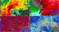
 Four panel NEXRAD image of the 2024 Hollister, Oklahoma tornado.jpg 3,840 × 1,813; 1.82 MB
-
 Greensburg3 small.gif 800 × 653; 131 KB
-
 Griffin Tornadoes.gif 1,208 × 720; 10.46 MB
-
 Hattiesburg radar feb 10 2013.png 1,117 × 645; 296 KB
-
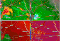
 January 9, 2012 Mission Bend, Texas tornado radar.png 960 × 720; 697 KB
-
 Koax 20140616 2055 BR 0.5.png 1,716 × 940; 914 KB
-
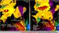
 May 24 2011 El Reno–Piedmont tornado radar image 440 PM CDT cropped.jpg 900 × 600; 158 KB
-
 May 24 2011 El Reno–Piedmont tornado radar image 440 PM CDT.jpg 986 × 998; 280 KB
-
 May 28, 2013 Bennington, Kansas tornado radar.gif 963 × 456; 5.21 MB
-
 Nc srm.gif 450 × 480; 25 KB
-
 NEXRAD loop of the Rolling Fork EF4 tornado.gif 1,127 × 626; 6.37 MB
-
 NEXRAD of a tornado between Egypt and Amory in Mississippi.jpg 1,712 × 945; 630 KB
-
 NEXRAD of the 2023 Hendersonville, Tennessee tornado.png 2,560 × 1,385; 3.38 MB
-
 NEXRAD radar of an EF2 tornado in Kansas on March 13, 2024.png 2,560 × 1,384; 2 MB
-
 NEXRAD radar of the Altamont, South Dakota EF3.png 3,440 × 1,308; 2.15 MB
-
 NEXRAD radar scan of the Bethel Springs, Tennessee EF3 tornado.png 1,716 × 940; 780 KB
-
 NEXRAD radar scan of the Cole, Oklahoma tornado.png 1,716 × 940; 1.25 MB
-
 NEXRAD radar scan of the Covington, Tennessee EF3 tornado.png 1,716 × 940; 1.35 MB
-
 NEXRAD radar scan of the Experiment tornado at peak intensity.png 1,716 × 940; 494 KB
-
 NEXRAD radar scan of the Kingston EF3.png 1,716 × 940; 502 KB
-
 NEXRAD radar scan of the Little Rock, AR EF3 tornado.png 1,716 × 940; 1.54 MB
-
 NEXRAD radar scan of the Robinson, Illinois - Sullivan, Indiana EF3 tornado.png 1,716 × 940; 1.32 MB
-
 NEXRAD radar scan of the Selma EF2.png 1,716 × 940; 866 KB
-
 NEXRAD radar scan of the tornado at peak intensity in Old Kingston.png 1,716 × 940; 831 KB
-
 NEXRAD radar scan of the West Point EF3.png 1,716 × 940; 1.35 MB
-
 QLCS.png 1,431 × 959; 155 KB
-
 Radar image of the 2011 Joplin tornado May 22, 2011 2248Z.png 1,117 × 635; 215 KB
-
 Radar image of the 2011 St. Louis tornado.png 850 × 837; 215 KB
-
 Radar image of the 2011 Tuscaloosa tornado April 27, 2011 2210Z.png 1,117 × 635; 286 KB
-
 Radar Image of the Deer Park EF3.png 1,716 × 940; 484 KB
-
 Radar scan of the Dortches, North Carolina tornado.png 1,716 × 940; 809 KB
-
 Radar Scan of the Selma Tornado.png 1,716 × 940; 195 KB
-
 Radar screenshot on July 12, 2023 from the TORD radar.jpg 3,422 × 1,881; 1.16 MB
-
 Radar-algorithme eng.gif 383 × 473; 320 KB
-
 Radar-algorithme eng.png 305 × 237; 115 KB
-
 Radar-algorithme fr.gif 383 × 473; 46 KB
-
 Raleigh supercell 2.png 641 × 628; 382 KB
-
 Rolling Fork Tornado.png 1,716 × 940; 1.38 MB
-
 Salina, KS Tornado ICT-SRM June 11, 2008.png 1,210 × 659; 34 KB
-
 Selma Tornado on Radar.png 1,716 × 940; 205 KB
-
 Selma, AL EF2.png 1,716 × 940; 845 KB
-
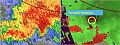
 Storm Relative Velocity Data for 2013 Granbury tornado.png 960 × 931; 316 KB
-
 Storm with hook echo near Frederick, Oklahoma 2056Z 20111107 (2).png 597 × 582; 310 KB
-
 Sulphur Tornado Radar Image.png 2,322 × 1,144; 5.03 MB
-
 Supercells near Oklahoma City, 02-10-2009.jpg 600 × 458; 80 KB
-
 The Rolling Fork, MS EF4 Tornado from COW1.png 1,716 × 940; 1.88 MB
-
 Tornado alexandria grlevel2.jpg 1,396 × 768; 415 KB
-
 Tornado doppler signature.PNG 785 × 748; 756 KB
-
 Tornado Vortex Sig, tuscaloosa.png 403 × 368; 114 KB
-
 Tornado-vortex-signature.jpg 522 × 342; 39 KB
-
 Velocity Little Sioux tornado.png 703 × 600; 291 KB
-
 Winona, MS EF3 on radar.png 1,716 × 940; 527 KB
-
 Yazoocity1714.png 1,031 × 679; 453 KB


.png)


