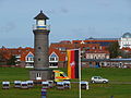
Category:Memmertfeuer (Juist)
Jump to navigation
Jump to search
| Object location | | View all coordinates using: OpenStreetMap |
|---|
lighthouse in Lower Saxony, Germany   | |||||
| Upload media | |||||
| Instance of | |||||
|---|---|---|---|---|---|
| Located in protected area | |||||
| Location | |||||
| Located in or next to body of water | |||||
| Inception |
| ||||
| Height |
| ||||
 | |||||
Media in category "Memmertfeuer (Juist)"
The following 19 files are in this category, out of 19 total.
-
 Juist, Hafen -- 2014 -- 3576.jpg 5,472 × 2,337; 6.12 MB
-
 Juist, Leuchtturm -- 2005 -- 1450.jpg 1,499 × 1,804; 1.7 MB
-
 Juist, Memmertfeuer -- 2014 -- 3528.jpg 5,472 × 2,175; 5.83 MB
-
 Juist, Memmertfeuer -- 2014 -- 3529.jpg 4,923 × 3,211; 7.43 MB
-
 Juist, Memmertfeuer -- 2014 -- 3533.jpg 3,634 × 3,634; 5.36 MB
-
 Juist, Memmertfeuer -- 2014 -- 3578.jpg 3,648 × 4,740; 12.84 MB
-
 Juist, Memmertfeuer -- 2014 -- 3579.jpg 5,472 × 3,648; 11.07 MB
-
 Juist, Memmertfeuer -- 2014 -- 3580.jpg 3,584 × 1,917; 8.25 MB
-
 Juists hafen April 2010 PD 25.JPG 4,272 × 2,848; 3.36 MB
-
 Leuchtturm Juist 2009.JPG 2,592 × 3,456; 4.18 MB
-
 Leuchtturm Juist.jpg 1,920 × 2,560; 4.7 MB
-
 Memmert Leuchtturm 1996.jpg 4,661 × 3,178; 15.2 MB
-
 Memmertfeuer 1883.jpg 5,184 × 3,456; 2.51 MB
-
 Memmertfeuer 1885.jpg 1,906 × 2,504; 1.27 MB
-
 Memmertfeuer 1907.jpg 3,991 × 2,661; 1,022 KB
-
 Memmertfeuer 5177.jpg 5,032 × 3,355; 2.14 MB
-
 Memmertfeuer 5178.jpg 5,228 × 3,485; 1.31 MB
-
 Notfalleinsatz am Leuchtturm.JPG 3,456 × 2,592; 4.24 MB
-
 Wasserturm Kirchturm Leuchtturm.JPG 3,648 × 2,736; 4.09 MB


Categories:
- Towers in Juist
- Memmert
- Juist harbour
- Lighthouses in Lower Saxony
- Lighthouses in Germany by name
- Brick buildings in Landkreis Aurich
- Brick towers in Lower Saxony
- Inactive lighthouses in Germany
- Brick lighthouses in Germany
- Unpainted lighthouses
- Round towers in Lower Saxony
- Observation towers in Landkreis Aurich