Category:Mareham Lane
Jump to navigation
Jump to search
road in Lincolnshire, England, UK | |||||
| Upload media | |||||
| Instance of | |||||
|---|---|---|---|---|---|
| Location | Lincolnshire, East Midlands, England | ||||
| |||||
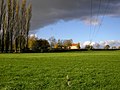
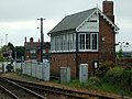
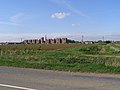
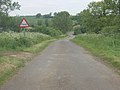
Mareham Lane is the modern name of a length of Roman Road that extended from its junction with King Street, just north of Bourne, Lincolnshire, up to the ford near Sleaford called Cogglesford. It passes, but does not go through, the settlements of Threekingham and Mareham-le-fen, and the ancient fair field at Stow Green Hill.
Modern Mareham Lane starts near Graby, then turns off the alignment a little short of Sleaford, and diverts into town to the railway crossing.
Media in category "Mareham Lane"
The following 23 files are in this category, out of 23 total.
-
 A farmhouse at Stow Green, nr Horbling Lincolnshire, England.JPG 2,560 × 1,920; 3.63 MB
-
 Beacon Hill Farm - geograph.org.uk - 277949.jpg 640 × 480; 107 KB
-
 Beacon Hill Farm - geograph.org.uk - 278433.jpg 640 × 480; 64 KB
-
 Brickmaker's Farm, Spanby - geograph.org.uk - 336960.jpg 640 × 427; 79 KB
-
 Cliff Beck Bridge - geograph.org.uk - 200258.jpg 640 × 427; 75 KB
-

-
 Disused farm building on Mareham Lane - geograph.org.uk - 182804.jpg 640 × 427; 56 KB
-
 Ford between Graby and Aslackby - geograph.org.uk - 154628.jpg 640 × 427; 89 KB
-
 Looking south along Mareham Lane - geograph.org.uk - 336973.jpg 640 × 427; 64 KB
-
 Mareham Lane - ford-Geograph-1822648-by-John-Walton.jpg 3,872 × 2,592; 2.4 MB
-
 Mareham Lane - geograph.org.uk - 269984.jpg 640 × 427; 74 KB
-

-
 Mareham Lane crossroads from A52-Geograph-1659867-by-Glyn-Drury.jpg 640 × 480; 54 KB
-
 Mareham Lane Farm buildings - geograph.org.uk - 254320.jpg 640 × 427; 64 KB
-

-
 Roman alignment, Graby (geograph 3156060).jpg 4,320 × 3,240; 5.38 MB
-
 Sleaford East - geograph.org.uk - 421934.jpg 640 × 480; 71 KB
-
 Stow Green Hill - geograph.org.uk - 1034236.jpg 640 × 427; 73 KB
-
 Stow Green Hill - geograph.org.uk - 336993.jpg 640 × 427; 80 KB
-
 The Drove - Mareham Lane-Geograph-1884993-by-Mick-Lobb.jpg 1,500 × 1,015; 1.49 MB
-
 The Maltings - geograph.org.uk - 410778.jpg 640 × 480; 73 KB
-
 The Mareham Lane ford - geograph.org.uk - 368085.jpg 640 × 480; 73 KB
-
 Mareham Lane - geograph.org.uk - 200252.jpg 640 × 427; 67 KB


.jpg)


