Category:March 2010 in Wales
Jump to navigation
Jump to search
English: Images taken in Wales in this month of 2010 (not the date of the upload).
| Jan | Feb | Mar | Apr | May | Jun | Jul | Aug | Sep | Oct | Nov | Dec | ||
| ← | 26 | 42 | 58 | 61 | 41 | 89 | 28 | 43 | 59 | 26 | 12 | 14 | → |
|---|
Subcategories
This category has the following 4 subcategories, out of 4 total.
Media in category "March 2010 in Wales"
The following 54 files are in this category, out of 54 total.
-
 Aberpergwm House, Glynneath, West Glamorgan, 6 March 2010.jpg 4,272 × 2,848; 5.44 MB
-
 All Saints Church, Mumbles.jpg 1,334 × 2,000; 880 KB
-
 Another Kissing Gate - geograph.org.uk - 1731261.jpg 427 × 640; 108 KB
-
 Bailey Street, Baneswell - geograph.org.uk - 1770512.jpg 640 × 480; 192 KB
-
 Bend in the Afon Gam - geograph.org.uk - 1774427.jpg 717 × 538; 189 KB
-
 Between hedgerows - Walterston - geograph.org.uk - 1732245.jpg 1,200 × 797; 1.23 MB
-
 Bracken burning South of Plynlimon - geograph.org.uk - 1741036.jpg 1,600 × 1,200; 372 KB
-
 Brick pillars of the Pontcysyllte Aqueduct - geograph.org.uk - 1805482.jpg 1,000 × 1,500; 195 KB
-

-
 Bridge 31 over the Llangollen Canal - geograph.org.uk - 1800126.jpg 1,500 × 966; 284 KB
-
 Bridge over the River Ceiriog - geograph.org.uk - 1754085.jpg 640 × 480; 70 KB
-
 Capel y Beirdd, Ynys - geograph.org.uk - 1745156.jpg 1,600 × 1,200; 727 KB
-

-
 Cromlech Rhoslan from the west - geograph.org.uk - 1762928.jpg 640 × 480; 81 KB
-
 CWL09.jpg 500 × 285; 64 KB
-
 Derelict house, Blaen-Baglan - geograph.org.uk - 1751606.jpg 3,296 × 2,472; 1.91 MB
-
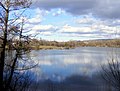 Fendrod Lake, Llansamlet, Swansea - geograph.org.uk - 1730706.jpg 640 × 486; 76 KB
-
 Fields near Llangattock - geograph.org.uk - 1765330.jpg 640 × 480; 75 KB
-
 Footbridge at Trevor Basin - geograph.org.uk - 1805497.jpg 1,500 × 1,000; 133 KB
-
 Gower meat selection at Swansea restaurant.jpg 4,272 × 2,848; 5.15 MB
-
 Head of the Llangollen Canal - geograph.org.uk - 1754227.jpg 640 × 480; 103 KB
-
 Joppa chapel - geograph.org.uk - 1766258.jpg 1,000 × 669; 347 KB
-

-
 Lambing season - geograph.org.uk - 1765350.jpg 480 × 640; 121 KB
-
 Lane past Flaxland-fach - Walterston - geograph.org.uk - 1732252.jpg 1,200 × 798; 769 KB
-
 Llangollen canal alongside A542 - geograph.org.uk - 1731940.jpg 640 × 480; 112 KB
-

-
 Malaysian Flag.jpg 2,521 × 1,559; 613 KB
-

-
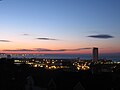 Meridian Tower Swansea Skyline.jpg 3,180 × 2,385; 1.49 MB
-
 Minor road near Cynnull-mawr farm - geograph.org.uk - 1774949.jpg 640 × 428; 160 KB
-
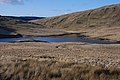 Nant-y-moch reservoir - geograph.org.uk - 1731215.jpg 1,000 × 669; 318 KB
-
 Old sheepfold below Cwm y Nant - geograph.org.uk - 1742047.jpg 640 × 480; 88 KB
-
 Path to Pentrebychan Road - geograph.org.uk - 1731280.jpg 427 × 640; 110 KB
-
 Pedestrianised street, Chepstow - geograph.org.uk - 1776264.jpg 640 × 480; 83 KB
-
 Railway bridge viewed from cycleway - geograph.org.uk - 1755631.jpg 640 × 480; 71 KB
-

-
 Rear view, Castle Farm, Raglan - geograph.org.uk - 1760785.jpg 640 × 427; 88 KB
-
 Rhydymwyn - geograph-2908110-by-Kevin-Williams.jpg 640 × 427; 94 KB
-

-
 River Dee from Llangollen Bridge - geograph.org.uk - 1731951.jpg 640 × 480; 100 KB
-
 River Usk at low tide - geograph.org.uk - 1740355.jpg 640 × 480; 84 KB
-
 Scargill cropped.jpg 229 × 181; 34 KB
-
 Scargill.jpg 390 × 744; 53 KB
-
 Somerset Road, Newport - geograph.org.uk - 1740180.jpg 640 × 629; 88 KB
-
 St Asaph - geograph-2908091-by-Kevin-Williams.jpg 640 × 427; 76 KB
-
 Stanner station - geograph.org.uk - 1780010.jpg 1,024 × 768; 182 KB
-
 The infant Afon Gam - geograph.org.uk - 1774209.jpg 480 × 640; 175 KB
-
 The lower end of Mostyn Street, Llandudno - geograph.org.uk - 1785025.jpg 1,024 × 530; 121 KB
-
 Track and footpath to Castle Cottage - geograph.org.uk - 1754482.jpg 640 × 427; 143 KB
-
 Traditional cottages at Rhoslan - geograph.org.uk - 1762961.jpg 1,024 × 769; 264 KB
-
 Tudur Dylan Jones.jpg 401 × 617; 71 KB
-
 Usk Valley Walk , path to Cat's Ash - geograph.org.uk - 1773784.jpg 640 × 480; 121 KB
-
 Walterston fach - Walterston - geograph.org.uk - 1732290.jpg 1,200 × 799; 864 KB


