Category:March 2009 in London
Jump to navigation
Jump to search
Deutsch: Bilder, die im März 2009 in London aufgenommen worden sind. Bitte beachten Sie, dass dies weder das Datum des Uploads noch das Datum des Scannens eines Fotos ist.
English: Images/pictures taken in London during March 2009. Note this is not the date of the upload, nor the date a photo was scanned.
Español: Fotografías o imágenes tomadas en London durante marzo 2009. No es la fecha de subida ni escaneo, sino la fecha en que las fotografías o imágenes se crearon.
Esperanto: Bildoj faritaj en London en marto 2009. Tio ne estas la dato, kiam la bildoj estis alŝutitaj aŭ skanitaj.
Français : Photographies ou images prises en London durant mars 2009. Ce n'est pas la date du téléchargement ou du scan.
Galego: Fotografías ou imaxes tomadas en London durante marzo 2009. Non é a data de subida nin escaneamento, senón a data na que se crearon as fotografías ou imaxes.
Italiano: Fotografie o immagini scattate a London nel marzo 2009. Nota bene: la data non si riferisce né a quella di upload né a quella in cui la foto è stata digitalizzata.
Norsk bokmål: Bilder tatt i London i løpet av mars 2009. Merk at dette ikke er datoen for opplasting, eller når et bilde har blitt skannet.
Norsk nynorsk: Bilete teke i London i løpet av mars 2009. Merk at dette ikkje er datoen for opplasting, eller når eit bilete har vorte skanna.
Русский: Изображения, сделанные в London в течение март 2009 (не дата загрузки изображения).
Українська: Зображення, зроблені в London протягом березень 2009. Зауважте, що це не дата завантаження чи дата сканування фотографії.
| March 2008 | ← | March 2009 | → | March 2010 | |||||||
| Jan | Feb | Mar | Apr | May | Jun | Jul | Aug | Sep | Oct | Nov | Dec |
| 625 | 390 | 776 | 635 | 141 | 883 | 306 | 649 | 295 | 1,179 | 524 | 331 |
|---|---|---|---|---|---|---|---|---|---|---|---|
Subcategories
This category has the following 35 subcategories, out of 35 total.
Media in category "March 2009 in London"
The following 200 files are in this category, out of 741 total.
(previous page) (next page)-
 Hugh llewelyn 165 024 (6678125609).jpg 4,592 × 3,056; 6.21 MB
-
 Upminster railway station 013.jpg 3,648 × 2,736; 4.34 MB
-
 Air vent 109 Lambeth Road - geograph.org.uk - 1215099.jpg 640 × 527; 88 KB
-
 Hugh llewelyn 444 012 (6437914841).jpg 4,592 × 3,056; 5.85 MB
-
 Hugh llewelyn 377 148 (6438356247).jpg 2,802 × 1,865; 791 KB
-
 Hugh llewelyn 377 125 (6438356263).jpg 2,802 × 1,865; 1.07 MB
-
 Hugh llewelyn 455 837 (6438356285).jpg 2,802 × 1,865; 1.2 MB
-
 Paddington station MMB 01 332XXX 332005 43XXX.jpg 2,372 × 1,579; 2.06 MB
-
 Paddington station MMB 02 332XXX 332007.jpg 2,400 × 1,600; 1.39 MB
-
 Paddington station MMB 03 332005 332013.jpg 2,400 × 1,600; 1.7 MB
-
 Paddington station MMB 04 43168 332005.jpg 2,378 × 1,562; 2.03 MB
-
 Paddington station MMB 05 43168.jpg 2,304 × 1,548; 1.73 MB
-
 Paddington station MMB 06 43041 43148 43122 332005.jpg 2,400 × 1,600; 2.14 MB
-
 Paddington station MMB 07.jpg 2,400 × 1,600; 2.37 MB
-
 Paddington station MMB 08.jpg 2,400 × 1,600; 1.65 MB
-
 Edgware Road tube station MMB 01.jpg 2,128 × 1,516; 1.72 MB
-
 Edgware Road tube station MMB 02 C-stock.jpg 2,400 × 1,600; 2.14 MB
-
 Edgware Road tube station MMB 03 C-stock.jpg 2,400 × 1,421; 1.41 MB
-
 Edgware Road tube station MMB 04 C-stock.jpg 2,291 × 1,506; 1.51 MB
-
 Farringdon station MMB 01.jpg 2,400 × 1,600; 2.18 MB
-
 Farringdon station MMB 02 377213.jpg 2,400 × 1,600; 2.13 MB
-
 Moorgate station MMB 01 C-Stock.jpg 2,347 × 1,488; 1.16 MB
-
 Hornsey TMD MMB 01 317038 365521.jpg 2,336 × 1,206; 1.04 MB
-
 Hornsey TMD MMB 02 365515 365530.jpg 2,313 × 1,425; 1.32 MB
-
 Hornsey TMD MMB 03 365515 313061.jpg 2,197 × 1,288; 1.31 MB
-
 Enfield Chase railway station MMB 01 313057.jpg 2,103 × 1,380; 1.23 MB
-
 Enfield Chase railway station MMB 02 313057.jpg 2,355 × 1,548; 1.8 MB
-
 Enfield Chase railway station MMB 03.jpg 2,400 × 1,600; 2.16 MB
-
 Enfield Chase railway station MMB 04 66139.jpg 2,283 × 1,528; 2.09 MB
-
 Enfield Chase railway station MMB 05 313046 313030.jpg 2,248 × 1,545; 2.17 MB
-
 Enfield Chase railway station MMB 06 313046 313030.jpg 2,400 × 1,600; 2.37 MB
-
 London MMB 01 Enfield.jpg 2,347 × 1,563; 2.47 MB
-
 London MMB 02 Enfield Chase Green.jpg 1,701 × 1,366; 1.55 MB
-
 London MMB 03 Enfield Chase Green.jpg 2,400 × 1,600; 2.47 MB
-
 London MMB 04 Northern City Line 313068.jpg 2,277 × 1,536; 1.47 MB
-
 Paddington station MMB 09.jpg 2,323 × 1,506; 1.95 MB
-
 Paddington station MMB 10.jpg 1,976 × 1,509; 2.13 MB
-
 Carnaby St At Night.jpg 3,888 × 2,592; 3.11 MB
-
 364 Lee High Road, Lewisham - geograph.org.uk - 1209879.jpg 640 × 480; 78 KB
-
 A20 past Swanley - geograph.org.uk - 1210803.jpg 640 × 427; 46 KB
-
 A20 past Swanley - geograph.org.uk - 1211074.jpg 640 × 427; 49 KB
-
 A20 towards Lewisham - geograph.org.uk - 1211085.jpg 640 × 427; 56 KB
-
 Acton Fire Station, Acton, London.jpg 3,264 × 2,448; 2.77 MB
-
 Acton Lane, Park Royal - geograph.org.uk - 1195061.jpg 480 × 640; 103 KB
-

-
 Ahmadiyya Mosque in Croydon.jpg 640 × 427; 68 KB
-
 Albert Victoria Street 5536.jpg 2,452 × 2,452; 2.81 MB
-
 Aldgate East tube station 055.jpg 3,648 × 2,736; 4.15 MB
-
 All Souls Avenue, Kensal Rise - geograph.org.uk - 1202384.jpg 640 × 480; 99 KB
-

-

-
 Almshouses at Mitcham - geograph.org.uk - 1220228.jpg 640 × 480; 62 KB
-
 Altab Ali Arch, Whitechapel - geograph.org.uk - 1278297.jpg 640 × 480; 105 KB
-
 Argyll Avenue - looking east - geograph.org.uk - 1263378.jpg 640 × 480; 141 KB
-
 Argyll Avenue - looking west - geograph.org.uk - 1263379.jpg 640 × 480; 116 KB
-

-

-

-
 Arkwrights Wheel, West Croydon, CR0 (3432145011).jpg 3,008 × 2,256; 2.5 MB
-
 Arlington Gardens, Chiswick - geograph.org.uk - 1188532.jpg 640 × 480; 95 KB
-

-

-
 Asda, Beddington - geograph.org.uk - 1186239.jpg 640 × 360; 50 KB
-
 Back of Darwin's laboratory - geograph.org.uk - 1200512.jpg 474 × 640; 120 KB
-
 Bakers Mews - geograph.org.uk - 1203151.jpg 480 × 640; 70 KB
-
 Baptistery area of St George's - geograph.org.uk - 1203759.jpg 640 × 480; 86 KB
-
 Barclays Bank, North End Road W14 - geograph.org.uk - 1229376.jpg 479 × 640; 59 KB
-
 Barge - geograph.org.uk - 1573609.jpg 640 × 480; 73 KB
-
 Barges loaded with shipping containers -2.jpg 1,024 × 768; 359 KB
-
 Barking - A modern folly - geograph.org.uk - 1210152.jpg 3,072 × 2,304; 1.41 MB
-
 Barking Town Hall - geograph.org.uk - 1210122.jpg 3,072 × 2,304; 1.38 MB
-
 Barking Town Hall - geograph.org.uk - 1210124.jpg 2,304 × 3,072; 1.38 MB
-
 Barrowgate Road, Chiswick - geograph.org.uk - 1188483.jpg 640 × 480; 114 KB
-
 Battersea Park - geograph.org.uk - 1573553.jpg 640 × 480; 97 KB
-
 Beccles Drive, Barking - geograph.org.uk - 1210615.jpg 3,072 × 2,304; 1.41 MB
-
 Beccles Drive, Barking - geograph.org.uk - 1210620.jpg 3,072 × 2,304; 1.44 MB
-
 Beddington Farm Road - geograph.org.uk - 1203670.jpg 640 × 480; 177 KB
-
 Beef burger (3352570237).jpg 2,816 × 2,112; 1.4 MB
-
 Beigel Shop, Brick Lane E1 - geograph.org.uk - 1268814.jpg 422 × 640; 278 KB
-

-
 Big Ben - Detalle.JPG 2,012 × 3,363; 2.7 MB
-
 Big Ben - Torre completa.JPG 2,304 × 3,456; 3.19 MB
-
 Big Ben at the foundry - geograph.org.uk - 1288308.jpg 640 × 480; 76 KB
-
 Big Ben de noche.JPG 2,304 × 3,456; 2.96 MB
-
 Big Yellow Storage, Small yellow Car, North London Railway London E3, 2005.jpg 1,712 × 1,194; 164 KB
-

-
 Bishopsgate Institute, Bishopsgate, EC2.jpg 2,520 × 3,776; 3.53 MB
-
 Blocked Road - geograph.org.uk - 1194526.jpg 640 × 480; 98 KB
-
 Blue Footbridge - geograph.org.uk - 1200499.jpg 640 × 426; 86 KB
-
 Boeing 737-800 (KLM) (3360846710).jpg 3,872 × 2,592; 3.65 MB
-
 Boeing 737-800 (KLM) Retro! (3360843586).jpg 3,872 × 2,592; 3.11 MB
-
 Borough Food Market (3788013491).jpg 2,048 × 1,536; 1.38 MB
-
 Borough Food Market (3788821094).jpg 2,048 × 1,536; 1.42 MB
-
 Borough Food Market (3788821966).jpg 2,048 × 1,536; 1.32 MB
-
 BP Connect, Corbets Tey Road - geograph.org.uk - 1222247.jpg 640 × 480; 75 KB
-
 Branfill Road - geograph.org.uk - 1239118.jpg 640 × 466; 81 KB
-
 Brett - or rather - ЬГEтт Concrete and St Mary's, Hackney Wick March 2009.jpg 1,770 × 1,176; 388 KB
-
 Brick Lane Coffee, Shoreditch, E1 (3342826042).jpg 3,648 × 2,736; 3.92 MB
-
 Brick Lane London.JPG 3,648 × 2,736; 4.12 MB
-
 Bridge in Beddington Park - geograph.org.uk - 1186403.jpg 640 × 360; 95 KB
-
 Broad Green Tavern, Broad Green, CR0 (3432972114).jpg 2,309 × 3,079; 3.13 MB
-
 Brook's Mews - geograph.org.uk - 1203109.jpg 640 × 480; 85 KB
-
 Bruce Grove station - geograph.org.uk - 2211901.jpg 1,600 × 1,200; 501 KB
-
 BT Office, West Croydon - geograph.org.uk - 1228169.jpg 480 × 640; 66 KB
-
 BT Tower-1.jpg 2,163 × 3,510; 5.74 MB
-
 Buchanan Gardens, Kensal Rise - geograph.org.uk - 1202394.jpg 640 × 479; 97 KB
-
 BuckinghamPalace2.JPG 3,448 × 1,696; 2.6 MB
-
 Buckley Road, Kilburn - geograph.org.uk - 1213902.jpg 640 × 480; 125 KB
-
 Buckley Road, Kilburn - geograph.org.uk - 1214882.jpg 480 × 640; 109 KB
-
 Building on Lee High Road - geograph.org.uk - 1210771.jpg 640 × 480; 98 KB
-
 Building west of Sainsburys - geograph.org.uk - 1568888.jpg 640 × 480; 74 KB
-
 Buildings in Stratford Place - geograph.org.uk - 1203672.jpg 640 × 495; 109 KB
-
-
 Burnt oak library.JPG 2,048 × 1,536; 813 KB
-
 Bus or Tube from Westminster^ - geograph.org.uk - 1202101.jpg 425 × 640; 38 KB
-
 Bus reflection - geograph.org.uk - 1192052.jpg 640 × 480; 83 KB
-
 Butlers, Old Ford, E9 (3399108119).jpg 3,289 × 2,193; 3.04 MB
-
 C-GHLM A30 AC star aliance 170309 (4498805989) (2).jpg 1,024 × 683; 305 KB
-
 Cabinas de teléfono de Londres.JPG 2,304 × 3,456; 3.23 MB
-
 Caledonian Arms, Bow, E3 (3543365533).jpg 3,776 × 2,520; 3.64 MB
-
 Cambridge Road, Barking - geograph.org.uk - 1209412.jpg 3,072 × 2,304; 1.37 MB
-
 Camden Lock willow tree.jpg 1,598 × 1,063; 320 KB
-
 Camden Road - geograph.org.uk - 1202455.jpg 640 × 480; 110 KB
-
 Camden Town Horse Hospital.jpg 1,024 × 768; 398 KB
-
 Camden Town-1.jpg 3,678 × 2,474; 6.56 MB
-
 Camden Town-2.jpg 3,534 × 2,356; 5.23 MB
-
 Camden Town-3.jpg 3,613 × 2,409; 6.11 MB
-

-
 Canary Wharf Time (3338834546).jpg 2,592 × 3,888; 2.05 MB
-
 Carew Manor, Beddington - geograph.org.uk - 1186381.jpg 517 × 289; 183 KB
-
 Carey Street - geograph.org.uk - 1195573.jpg 480 × 640; 117 KB
-
 Carshalton London Borough of Sutton Waterfall The pond 2.jpg 4,282 × 2,840; 2.32 MB
-
 Cat Hill Roundabout, Cockfosters - geograph.org.uk - 1230785.jpg 640 × 480; 96 KB
-
 Cat Hill, Cockfosters (A110) - geograph.org.uk - 1226752.jpg 640 × 481; 106 KB
-
 Cavendish Gardens, Barking - geograph.org.uk - 1210523.jpg 3,072 × 2,304; 1.34 MB
-
 Cavendish Gardens, Barking - geograph.org.uk - 1210537.jpg 3,072 × 2,304; 1.44 MB
-
 Cecil Sharp House-1.jpg 3,619 × 2,413; 7 MB
-
 Cedar marking St Mary's church - geograph.org.uk - 1279975.jpg 640 × 480; 73 KB
-
 Chancery Lane roundel.jpg 640 × 480; 34 KB
-

-

-
 Charing Cross underground steps - geograph.org.uk - 1201358.jpg 640 × 426; 66 KB
-
 Charlton Kingdom Hall, Invicta Road - geograph.org.uk - 1197193.jpg 640 × 480; 267 KB
-
 Charter Avenue, Ilford - geograph.org.uk - 1212543.jpg 640 × 438; 78 KB
-
 Chelsea Old Church, Cheyne Walk, Doorway - geograph.org.uk - 1569949.jpg 480 × 640; 101 KB
-

-
 Chiswick High Road - geograph.org.uk - 2665349.jpg 1,137 × 1,134; 475 KB
-
 Church End Library.JPG 2,048 × 1,536; 812 KB
-
 Church Road Harlesden - geograph.org.uk - 1202536.jpg 640 × 480; 74 KB
-

-
 Church Row, Hampstead - geograph.org.uk - 1191411.jpg 479 × 640; 140 KB
-
 City Pride - panoramio.jpg 3,661 × 2,440; 3.08 MB
-
 Clairmont Close - geograph.org.uk - 1224904.jpg 640 × 427; 82 KB
-

-
 Cochrane Mews - geograph.org.uk - 1193035.jpg 480 × 640; 79 KB
-
 Coldharbour Lane - geograph.org.uk - 1208675.jpg 640 × 360; 84 KB
-

-
 Colourful flags alongside The Mall - geograph.org.uk - 1232978.jpg 640 × 480; 86 KB
-
 Commonwealth Day 2009 (Westminster Abbey).jpg 1,899 × 1,101; 327 KB
-
 Coniston Gardens - geograph.org.uk - 1202534.jpg 640 × 480; 78 KB
-
 Cos Bar - geograph.org.uk - 1231447.jpg 507 × 640; 91 KB
-
 Cottages in Church Lane, Beddington - geograph.org.uk - 1186446.jpg 640 × 480; 62 KB
-
 Cottages in Wrights Row - geograph.org.uk - 1208880.jpg 640 × 480; 123 KB
-
 Cottages on Kew Green - geograph.org.uk - 1229005.jpg 480 × 640; 96 KB
-
 Cottages, Broom Hill - geograph.org.uk - 1195601.jpg 640 × 480; 169 KB
-
 County Court, North End Road W14 - geograph.org.uk - 1229455.jpg 640 × 479; 63 KB
-

-
 Craig's Court, London, SW1 - geograph.org.uk - 1202109.jpg 640 × 514; 83 KB
-
 Cranbourne Gardens - geograph.org.uk - 1222221.jpg 640 × 480; 63 KB
-
 Crane in Grove Lane - geograph.org.uk - 1193082.jpg 640 × 578; 118 KB
-
 Cranford Park - geograph.org.uk - 1219761.jpg 640 × 445; 143 KB
-
 Crazy Bear, Fitzrovia, W1 (3408004602).jpg 2,292 × 3,437; 3.02 MB
-
 Crocus on green, Merrivale, London N14 - geograph.org.uk - 1225162.jpg 640 × 393; 173 KB
-
 Crocus on green, Merrivale, London N14 - geograph.org.uk - 1225168.jpg 640 × 426; 189 KB
-
-
 Crocuses, Sheringham Avenue, London N14 - geograph.org.uk - 1225179.jpg 640 × 426; 188 KB
-
 Crosby Hall, Cheyne Walk, Window - geograph.org.uk - 1569952.jpg 480 × 640; 101 KB
-
 Crouch End allotments - geograph.org.uk - 1212406.jpg 640 × 480; 174 KB
-
 Croydon Airport - geograph.org.uk - 1208636.jpg 640 × 360; 52 KB
-
 Cumberland Gardens - geograph.org.uk - 1224796.jpg 427 × 640; 84 KB
-
 Cycle Racing - geograph.org.uk - 1199929.jpg 640 × 455; 98 KB
-
 Damaged roadside post - geograph.org.uk - 1188032.jpg 640 × 418; 60 KB
-
 Daniel Road - geograph.org.uk - 1273458.jpg 640 × 480; 91 KB
-
 Darwin's greenhouse, Down House - geograph.org.uk - 1200495.jpg 640 × 480; 125 KB
-
 Darwin's Mulberry Tree, Down House - geograph.org.uk - 1196056.jpg 425 × 640; 84 KB
-
 Decorative stone on the Chapel of Gray's Inn.jpeg 480 × 640; 89 KB
-
 Derry Downs - geograph.org.uk - 1219877.jpg 640 × 480; 96 KB
-
 Derry Downs - geograph.org.uk - 1219878.jpg 640 × 480; 87 KB
-
 Derry Downs - geograph.org.uk - 1219881.jpg 640 × 480; 76 KB
-
 Development Lygon Place Ebury Street - geograph.org.uk - 1194340.jpg 640 × 480; 108 KB
-
 Disused Garage - geograph.org.uk - 1194532.jpg 640 × 594; 105 KB
-
 Disused shops in Thorndike Street - geograph.org.uk - 1194297.jpg 640 × 480; 66 KB
-

-
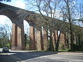 Dollis brook viaduct.JPG 2,048 × 1,536; 793 KB
-
 Dome of St Paul's Cathedral - geograph.org.uk - 1231360.jpg 511 × 640; 86 KB
-
 Door with a big drop - geograph.org.uk - 1192057.jpg 480 × 640; 76 KB
-
 Down House, Downe, Kent, England -greenhouse-28March2009.jpg 3,200 × 1,948; 3.21 MB
-
 DownHouse.jpg 10,746 × 1,996; 3.73 MB
-

-

.jpg)


.jpg)
.jpg)
.jpg)
.jpg)


.jpg)


.jpg)


_(3360846710).jpg)
_Retro!_(3360843586).jpg)
.jpg)
.jpg)
.jpg)


.jpg)


.jpg)


.jpg)
_(2).jpg)

.jpg)


.jpg)


_-_geograph.org.uk_-_1226752.jpg)


.jpg)


.jpg)


_-_geograph.org.uk_-_1230018.jpg)
_-_geograph.org.uk_-_1267603.jpg)