Category:Maps with azimuthal projection
Jump to navigation
Jump to search
English: Maps with azimuthal projection are projected onto a plane. They also all have the property that they are azimuthal, that all directions from one point is preserved. For more see Map projection.
English: This map-projection-related category exists in the following hierarchy:
- Category:Map projections
- Category:Maps by projection
- Category:Azimuthal projection – media related to the Azimuthal projection other than maps
- Category:Maps with azimuthal projection (“Category:azimuthal projections”) – maps made using the Azimuthal projection
Subcategories
This category has the following 6 subcategories, out of 6 total.
Media in category "Maps with azimuthal projection"
The following 17 files are in this category, out of 17 total.
-
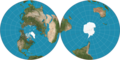
 Antarctica interglacial hg.png 1,117 × 764; 402 KB
-
 Antarctica interglacial hg.svg 512 × 512; 273 KB
-
 Antarctica Subglacial Lakes Map.png 540 × 462; 107 KB
-
 Antarctica unlabeled physical map.jpg 5,400 × 4,376; 1.15 MB
-
 Antarktischer Ozean.png 330 × 330; 11 KB
-
 CET-24hr-NorthPolarProjection.png 1,280 × 1,024; 405 KB
-
 Delisle 1739..jpg 998 × 858; 279 KB
-
 Flat earth.jpg 498 × 498; 31 KB
-
 Gbgradio1.jpg 1,558 × 1,511; 525 KB
-
 Gott-Goldberg-Vanderbei Projection.png 2,058 × 1,037; 2.73 MB
-
 Grl-map-Ostenfeld-1902.gif 2,640 × 3,173; 838 KB
-
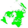 Mapamundi polar.png 836 × 841; 55 KB
-
 Mundo polar.png 1,104 × 949; 95 KB
-

-
 UTC hue4map X world CET-24h-NorthPolarProjection.png 1,280 × 1,024; 246 KB
-
 Vs equidistant azimuthaal 100 40.PNG 769 × 653; 129 KB
-
 Vzdalenosti Země - Distances of the Earth (1965).jpg 5,055 × 3,382; 2.04 MB


.jpg)