Category:Maps showing 476
Jump to navigation
Jump to search
| 475 476 477 → |
English: Maps showing the year 476 (i.e. history maps)
See also category: 476 maps. and 470s maps for old maps created in this time.
See also category: 476 maps. and 470s maps for old maps created in this time.
Media in category "Maps showing 476"
The following 11 files are in this category, out of 11 total.
-
 3Byzantium476.PNG 800 × 370; 62 KB
-
 3Byzantium476lightblue-es.svg 925 × 424; 199 KB
-
 3Byzantium476lightblue.PNG 800 × 370; 25 KB
-
 476 CE, Europe.svg 512 × 438; 1.48 MB
-
 628px-Western and Eastern Roman Empires 476AD(3).PNG 528 × 259; 11 KB
-
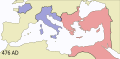
 628px-Western-Eastern-Roman-Empires-476AD.PNG 528 × 259; 17 KB
-
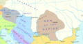 Carpathian Basin in 476 AD.png 800 × 424; 234 KB
-
 East-Hem 476ad (cropped).jpg 1,042 × 685; 167 KB
-
 East-Hem 476ad.jpg 3,240 × 1,903; 754 KB
-
 Eastern Roman Empire 476.png 3,998 × 1,835; 656 KB
-
 Western and Eastern Roman Empires 476AD(3).svg 660 × 324; 141 KB


.PNG)


.jpg)


.svg)