Category:Maps showing 1791
Jump to navigation
Jump to search
| ← 1790 1791 1792 1793 1794 1795 1796 1797 1798 1799→ |
English: Maps showing the year 1790 (i.e. history maps)
See also category: 1790 maps. and 1790s maps for old maps created in this time.
See also category: 1790 maps. and 1790s maps for old maps created in this time.
Media in category "Maps showing 1791"
The following 10 files are in this category, out of 10 total.
-

-

-
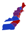 2nd United States Congress Senators.svg 429 × 543; 17 KB
-
 Atlas général de la France - France 1791 - E. Cortambert.jpg 1,738 × 1,697; 417 KB
-
 Ireland location 1791.PNG 470 × 486; 17 KB
-

-
 Non-Native American Nations Control over N America 1791.png 800 × 895; 159 KB
-
 Non-Native Nations Claim over NAFTA countries 1791.png 800 × 895; 161 KB
-
 United States 1791-03-1791-09.png 1,000 × 677; 48 KB
-
 United States 1791-09-1792-03.png 1,000 × 677; 48 KB
.jpg)
.jpg)


