Category:Maps of the Western Bug
Jump to navigation
Jump to search
Media in category "Maps of the Western Bug"
The following 16 files are in this category, out of 16 total.
-
 Bieraście, Buh. Берасьце, Буг (1700-1830).jpg 10,652 × 12,659; 21.59 MB
-
 Cours du Bug occ.png 426 × 392; 80 KB
-
 CuencaDelVístula.svg 656 × 685; 5.31 MB
-
 Flumina in limitem orientalem Poloniae.PNG 156 × 472; 7 KB
-
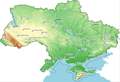
 Hydrographic zoning Ukraine.jpg 3,357 × 2,166; 3.12 MB
-
 Route of Bug River in Finnish.png 426 × 392; 90 KB
-
 Route of Bug River in German.png 888 × 820; 844 KB
-
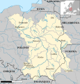
 Schema Zachodniaha Buha.png 422 × 389; 86 KB
-
 The Vistula river basin in Ukraine border.png 832 × 569; 464 KB
-
 The Vistula river basin in Ukraine zoomed.png 570 × 655; 494 KB
-
 The Vistula river basin in Ukraine.png 834 × 570; 462 KB
-
 UkraineNWpripjat hu.svg 1,036 × 548; 287 KB
-
 UkraineNWpripjat.png 777 × 411; 219 KB
-
 Vistula river map hu.svg 1,333 × 1,440; 1.51 MB
-
 Vistula river map.png 1,000 × 1,080; 1.17 MB
-
 Карта Буг.JPG 3,264 × 2,448; 2.66 MB
.jpg)


