Category:Maps of the Tennessee River
Jump to navigation
Jump to search
Media in category "Maps of the Tennessee River"
The following 53 files are in this category, out of 53 total.
-
 (Map of northwest Alabama and northeast Mississippi). LOC 2006635328.jpg 6,917 × 4,559; 4.3 MB
-
 1815m4.jpg 1,689 × 1,442; 147 KB
-

-
 Bulletin (1942) (20425145005).jpg 4,934 × 1,932; 867 KB
-
 Diagram of Tennessee Valley Authority Water Control System (79440).jpg 2,125 × 3,306; 2.89 MB
-
 File-The Suck, or the Hazards of the Tennessee River Gorge.jpg 3,000 × 2,400; 1.07 MB
-
 Harrington-map-bussell-area-1922.gif 608 × 830; 34 KB
-
 K-1979 (10984514674).jpg 2,152 × 1,720; 2.2 MB
-
 Land use plan of TVA's failed Timberlake City project.png 1,791 × 812; 1.94 MB
-
 LowsKentuckyMap.jpeg 2,748 × 2,284; 2.91 MB
-

-

-

-

-

-

-

-

-

-

-

-
-
-

-

-
-

-

-

-
-
-

-
-

-

-

-
-

-
-

-

-
-

-

-

-

-
-
 Map of the Tennessee Valley Authority - NARA - 195895.tif 2,000 × 1,226; 2.36 MB
-
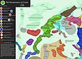 Paramountcy of Coosa.jpg 1,048 × 763; 162 KB
-
 Tennessee River.jpg 961 × 916; 1.31 MB
-
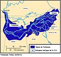
 Tennessee watershed.png 473 × 475; 220 KB
-
 TVAmap2.jpg 800 × 737; 152 KB
-
 USACE Divide Cut map large.png 1,902 × 1,242; 560 KB
._LOC_2006635328.jpg)

.jpg)
.jpg)


.jpg)


_(20425145005).jpg)