Category:Maps of the Ostrogoths
Jump to navigation
Jump to search
Subcategories
This category has the following 2 subcategories, out of 2 total.
M
Media in category "Maps of the Ostrogoths"
The following 18 files are in this category, out of 18 total.
-
 0375 Ukraine.png 1,657 × 1,225; 1.03 MB
-
 500 fall-roman-empire-fr.svg 1,648 × 1,049; 1.83 MB
-
 528 CE, Europe.svg 512 × 438; 1.5 MB
-
 Ahdufour1zoomed.png 1,351 × 909; 1.54 MB
-
 Arianizmus u Germánov.png 4,096 × 3,755; 1.41 MB
-
 Carpathian Basin in 476 AD.png 800 × 424; 234 KB
-
 Europe and the Near East at 476 AD.png 2,830 × 1,967; 1.58 MB
-
 Gothic Kingdoms.png 608 × 342; 59 KB
-
 Gutthiuda.jpg 800 × 547; 460 KB
-
 Kmene v Podunají.png 982 × 642; 688 KB
-
 Lombard state 526-pt.svg 950 × 550; 47 KB
-
 Map of the Christian world around the mediterranean in the 5th century AD.png 1,117 × 653; 206 KB
-
 Mapa da Europa c.500 (com legenda).png 1,985 × 1,686; 444 KB
-
 Mapa da Europa c.500 (sem legenda).png 1,985 × 1,686; 301 KB
-
 Marcellinus Dalmatia-it.svg 822 × 750; 118 KB
-
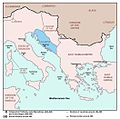 Marcellinus Dalmatia.jpg 1,054 × 1,041; 98 KB
-
 Mitteleuropa BV042512124.jpg 1,954 × 1,337; 302 KB
-
 Ostrogoths, Antes, Huns and Alans in 380.jpg 612 × 316; 60 KB


.png)
.png)


