Category:Maps of the Metropolitan Borough of Sefton
Jump to navigation
Jump to search
Subcategories
This category has the following 2 subcategories, out of 2 total.
E
- Election maps of Sefton (5 F)
S
- Maps of Southport (12 F)
Media in category "Maps of the Metropolitan Borough of Sefton"
The following 7 files are in this category, out of 7 total.
-
 Bootle and Crosby unparished area UK locator map.svg 707 × 1,306; 286 KB
-
 EnglandSefton.png 200 × 247; 27 KB
-
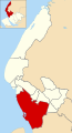
 MerseysideSefton.png 200 × 211; 14 KB
-
 River Mersey map.png 1,403 × 571; 1.18 MB
-
 Sefton UK locator map.svg 1,231 × 1,305; 782 KB
-
 Sefton UK ward map 2010 (blank).svg 707 × 1,306; 312 KB
-
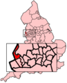
 SeftonCentralConstituency.svg 500 × 500; 29 KB


.svg)