Category:Maps of the Mali Empire
Jump to navigation
Jump to search
Media in category "Maps of the Mali Empire"
The following 32 files are in this category, out of 32 total.
-
 The Mali Empire.jpg 3,000 × 2,250; 3.07 MB
-
 Africa historical traite.JPG 2,667 × 2,287; 572 KB
-
 African-civilizations-map-imperial.png 2,000 × 1,863; 4.67 MB
-
 African-civilizations-map-pre-colonial es.svg 1,390 × 1,295; 294 KB
-
 African-civilizations-map-pre-colonial mk.svg 1,390 × 1,295; 947 KB
-
 African-civilizations-map-pre-colonial.svg 1,390 × 1,295; 488 KB
-
 Empire du Mali carte Fr.png 1,579 × 986; 172 KB
-
 MALI empire BLANK.PNG 1,580 × 988; 60 KB
-
 MALI empire BLANK.svg 1,668 × 1,214; 43 KB
-
 Mali empire map - 1350 AD - el.svg 512 × 366; 15 KB
-
 MALI empire map-ar.png 1,580 × 994; 125 KB
-
 MALI empire map.PNG 1,580 × 994; 70 KB
-
 MALI reich Karte.PNG 1,580 × 994; 49 KB
-
 Maliko inperioa.png 1,580 × 994; 124 KB
-
 Maliko inperioa.svg 2,107 × 1,325; 170 KB
-
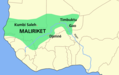 Maliriket.png 1,580 × 994; 50 KB
-
 Map of ancient and Medieval Sub-Saharan states zoomed in.jpg 658 × 519; 131 KB
-
 Map of the Mali Empire.png 2,030 × 1,431; 50 KB
-
 Mapa Imperio de Mali.jpg 4,213 × 2,277; 15.11 MB
-
 Mapa mali cy.svg 1,668 × 1,214; 68 KB
-
 Mapa mali-pt.svg 512 × 366; 16 KB
-
 Mapa mali.svg 1,668 × 1,214; 75 KB
-
 WestAfrica1350-ar.png 413 × 291; 18 KB
-
 WestAfrica1350-es.svg 606 × 397; 496 KB
-
 WestAfrica1350-pt.svg 606 × 397; 496 KB
-
 WestAfrica1350.png 413 × 291; 14 KB
-
 WestAfrica1530-es.svg 606 × 397; 560 KB
-
 WestAfrica1530-pt.svg 606 × 397; 490 KB
-
 WestAfrica1530.png 431 × 287; 16 KB
-
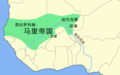 Zh MALI empire map.png 1,580 × 994; 46 KB
-
 Αυτοκρατορία Μάλι χάρτης.png 1,580 × 994; 47 KB
-
 Доколоніальні цивілізації Африки.svg 1,390 × 1,295; 486 KB


