Category:Maps of the London Borough of Wandsworth
Jump to navigation
Jump to search
Subcategories
This category has the following 2 subcategories, out of 2 total.
E
- Election maps of Wandsworth (7 F)
Media in category "Maps of the London Borough of Wandsworth"
The following 15 files are in this category, out of 15 total.
-
 Rocque Battersea.png 1,443 × 1,642; 4.52 MB
-
 Borough of Wandsworth Community Vulnerability Index 2018.png 566 × 459; 368 KB
-
 LondonWandsworth.svg 962 × 744; 19 KB
-
 Map of Surrey Sheet 007, Ordnance Survey, 1871-1882.jpg 10,750 × 7,203; 19.97 MB
-
 Map-Roehampton.jpg 369 × 579; 46 KB
-
 Map-Roehampton.png 374 × 615; 103 KB
-
 Printed Map Descriptive of London Poverty 1898-1899. Sheet 10. South West District (22128198814).jpg 11,597 × 6,651; 13.09 MB
-
 Stanford 1891 Chelsea bridges.jpg 700 × 474; 145 KB
-
 Stanford 1891 Chelsea bridges.png 700 × 474; 698 KB
-
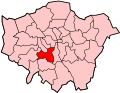
 Wandsworth in Greater London.svg 1,425 × 1,140; 1.39 MB
-
 Wandsworth London UK blank ward map 2002 to 2022.svg 1,425 × 1,258; 352 KB
-
 Wandsworth London UK blank ward map 2022.svg 1,425 × 1,258; 1.54 MB
-
 Wandsworth London UK labelled ward map 2002.svg 1,346 × 1,116; 81 KB
-
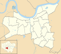
 Wandsworth London UK location map.svg 1,425 × 1,258; 3.36 MB
-
 Wandsworthdistrict.png 914 × 662; 81 KB


.jpg)


