Category:Maps of the London Borough of Hammersmith and Fulham
Jump to navigation
Jump to search
Subcategories
This category has only the following subcategory.
E
Media in category "Maps of the London Borough of Hammersmith and Fulham"
The following 15 files are in this category, out of 15 total.
-
 Fulham 1746.png 1,159 × 1,165; 2.92 MB
-
 Fulham 1891.png 2,329 × 2,029; 8.63 MB
-
 Hammersmith and Fulham London UK blank ward map 2002 to 2022.svg 891 × 1,266; 301 KB
-
 Hammersmith and Fulham London UK blank ward map 2022.svg 891 × 1,266; 307 KB
-
 Hammersmith and Fulham London UK labelled ward map 2002.svg 797 × 1,266; 68 KB
-
 Hammersmith and Fulham London UK location map.svg 891 × 1,266; 2.42 MB
-
 Hammersmith and Fulham London UK ward map 1978 to 2002.svg 891 × 1,266; 407 KB
-
 Hammersmith and Fulham UK locator map.svg 1,425 × 1,140; 1.06 MB
-
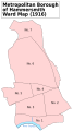 Hammersmith Met. B Ward Map 1916.svg 585 × 1,052; 52 KB
-
 LondonHammersmithFulham.png 200 × 155; 23 KB
-
 LondonHammersmithFulham.svg 962 × 744; 19 KB
-
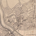
 ShepherdsBush Davies map 1841.jpg 184 × 193; 95 KB
-
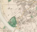
 White City, London.png 936 × 397; 746 KB
-
 Willesden Junction map with Old Oak Common.png 1,467 × 903; 1.15 MB
-
 Willesden junction map.png 1,467 × 903; 1.29 MB


