Category:Maps of the Karelian Isthmus
Jump to navigation
Jump to search
English: Maps of the Karelian Isthmus, located on the Gulf of Finland in the Karelia Region.
- Pre-WWII renditions when in the historic Karelia Province of Finland, and contemporary renditions in Leningrad Oblast of Russia.
Subcategories
This category has the following 2 subcategories, out of 2 total.
M
Media in category "Maps of the Karelian Isthmus"
The following 31 files are in this category, out of 31 total.
-
 013 huuhta evolution.jpg 1,200 × 1,203; 457 KB
-
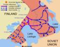
 Continuation-War-defensive-lines.png 800 × 584; 78 KB
-
 Ekaterinmap.jpg 670 × 512; 87 KB
-
 General map of the Grand Duchy of Finland 1863 Sheet F5.jpg 6,051 × 7,033; 2.52 MB
-
 Ingermanland 1700 bis 1704.png 800 × 892; 203 KB
-
 Ingermanland 1708.png 703 × 725; 215 KB
-
 Karelen Karjala.png 826 × 1,168; 2.25 MB
-
 Karelian Isthmus Finnish positions 1939-et.png 600 × 583; 145 KB
-
 Karelian Isthmus Finnish positions 1939.png 600 × 583; 65 KB
-
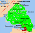
 Karelian Isthmus in Finnish.png 645 × 610; 114 KB
-
 Karelian Isthmus offensive February March.png 823 × 800; 392 KB
-
 Karelian Isthmus RUS.png 823 × 800; 137 KB
-
 Karelian Isthmus.png 823 × 800; 99 KB
-
 Karjalankannas (mukana Suomen raja v. 1940).png 645 × 610; 119 KB
-
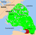 Karjalankannas.png 617 × 600; 127 KB
-
 Karjalankannas.PNG 645 × 610; 121 KB
-
 Karta Delagardi.gif 817 × 545; 333 KB
-
 La2-demis-karelian-isthmus.png 903 × 869; 344 KB
-
 Ligne Mannerheim.png 600 × 476; 131 KB
-
 Mainila.png 600 × 583; 57 KB
-
 Mannerheim vonal.PNG 600 × 476; 46 KB
-
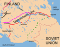
 Mannerheim-line.png 600 × 476; 50 KB
-
 Mannerheim-Linie.png 600 × 476; 62 KB
-
 Map of Finnish operations in Karelia in 1941.png 992 × 773; 278 KB
-
 Mazelki.jpg 935 × 250; 90 KB
-
 MLSS.png 640 × 508; 131 KB
-
 Nöteborgi béke.png 600 × 548; 19 KB
-
 Rjabovo1885.png 650 × 363; 430 KB
-
 Soviet-finnish negotiations 1939 borderline.png 590 × 404; 37 KB
-
 Suomen asutus keskiajan alussa.png 800 × 636; 795 KB
-
 Treaty-of-Nöteborg.png 600 × 548; 26 KB


.png)


