Category:Maps of the Holy Land by Abraham Ortelius
Jump to navigation
Jump to search
English: This map design should not be confused with the similar-looking Category:Maps of the Holy Land by Mercator-Hondius, which was created after Ortelius.
Another derivative map was the one by Michel van Lochom.
Another derivative map was the one by Michel van Lochom.
Media in category "Maps of the Holy Land by Abraham Ortelius"
The following 13 files are in this category, out of 13 total.
-
 Cartouche en medaillons met het leven van Christus, BI-1934-1775-23-2.jpg 1,788 × 1,078; 405 KB
-
 Elaborate cartouche on a Holy Land map by Schrot.jpg 4,036 × 2,165; 2.46 MB
-

-

-
 Abraham Ortelius, Terra Sancta (FL199657691 2368834).jpg 8,000 × 6,418; 27.46 MB
-

-
 Palestine (1889 book) 06.jpg 1,781 × 1,471; 400 KB
-
 Abraham Ortelius, Terra Sancta (FL199985668 2368835).jpg 9,040 × 7,244; 37.49 MB
-
 Abraham Ortelius, Terra Sancta (FL199657686 2368837).jpg 8,200 × 6,080; 28.77 MB
-
 Abraham Ortelius, Terra Sancta (FL199657724 2368838).jpg 9,064 × 7,236; 39.06 MB
-
 ORTELIUS' Terra Sancta.jpg 3,200 × 2,382; 603 KB
-
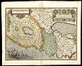
 Map of the Holy Land by Abraham Ortelius.jpeg 3,063 × 2,360; 2.3 MB
-
 Medusa scale cartouche on a Holy Land map by Schrot.jpg 4,099 × 1,722; 1.93 MB


.jpg)

_06.jpg)
.jpg)
.jpg)
.jpg)


.jpg)