Category:Maps of the Hittite Empire in the 9th-century BC
Jump to navigation
Jump to search
| NO WIKIDATA ID FOUND! Search for Maps of the Hittite Empire in the 9th-century BC on Wikidata | |
| Upload media |
Media in category "Maps of the Hittite Empire in the 9th-century BC"
The following 11 files are in this category, out of 11 total.
-
 Adadnirari2-abans 900.png 892 × 1,000; 271 KB
-
 Adadnirari2-després900.PNG 890 × 1,000; 295 KB
-
 Alter Orient 0900BC.svg 2,102 × 1,510; 4.93 MB
-
 Ancient Near East 0900BC.svg 2,102 × 1,510; 4.92 MB
-
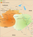
 Aramaic kingdoms and chiefdoms around 10-9th century BC (es).svg 3,126 × 1,978; 386 KB
-
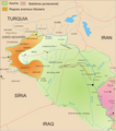
 Aramaic kingdoms and chiefdoms around 10-9th century BC.svg 814 × 515; 163 KB
-
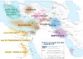
 Aramean states.png 1,146 × 1,200; 548 KB
-
 Assurnasirpal2.png 1,143 × 1,200; 450 KB
-
 Bit-bahiani.he.svg 814 × 515; 164 KB
-
 Salmanassar3.png 1,145 × 1,200; 494 KB
-
 Tukultininurta2.png 887 × 1,000; 287 KB


.svg)


