Category:Maps of the Battle of Austerlitz
Jump to navigation
Jump to search
Media in category "Maps of the Battle of Austerlitz"
The following 22 files are in this category, out of 22 total.
-
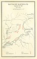 149 of 'The First Napoleon. A sketch political and military' (11175952466).jpg 1,337 × 2,146; 465 KB
-

-

-
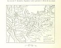 538 of 'Napoléon et son temps ... Ouvrage illustré ... Neuvième mille' (11236127475).jpg 1,768 × 1,395; 636 KB
-
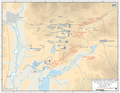
 Austerlitz campaign - General situation, 25 November 1805.jpg 3,737 × 2,935; 4.11 MB
-
 Austerlitz campaign - Pursuit to Vienna, 26 October-15 November 1805.jpg 3,759 × 2,904; 3.4 MB
-
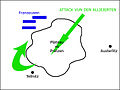 Austerlitz Plang Alliéiert.jpg 400 × 300; 19 KB
-
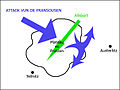 Austerlitz Plang Napoleon.jpg 400 × 300; 20 KB
-
 Battle of Austerlitz - Situation at 0900, 2 December 1805.png 3,759 × 2,911; 652 KB
-
 Battle of Austerlitz - Situation at 1400, 2 December 1805.png 3,739 × 2,881; 622 KB
-
 Battle of Austerlitz, Situation at 1800, 1 December 1805-ar.png 2,560 × 1,976; 1.64 MB
-
 Battle of Austerlitz, Situation at 1800, 1 December 1805.png 3,752 × 2,896; 726 KB
-

-

-
 Map Austerlitz War and Peace page 697.png 3,100 × 2,354; 97 KB
-
 Meyers b2 s0139 b1.png 770 × 496; 197 KB
-
 Plan der Schlacht bey Austerlitz 1805.jpg 1,710 × 1,207; 2.02 MB
-
 PlanSchlachtAusterlitz.jpg 2,187 × 1,690; 1.41 MB
-
 Russian map of the Battle of Austerlitz.jpg 1,432 × 1,316; 242 KB
-
 Schlacht bei Austerlitz.jpg 730 × 458; 321 KB
-
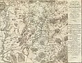
 Alison's history of Europe atlas 1850 (92102511).jpg 7,106 × 5,754; 6.22 MB
-
.jpg)
.jpg)
.jpg)
.jpg)


.jpg)


.jpg)
.jpg)