Category:Maps of temperature variation
Jump to navigation
Jump to search
Media in category "Maps of temperature variation"
The following 6 files are in this category, out of 6 total.
-
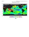 509649main lanina stronger2.pdf 1,275 × 1,650; 466 KB
-
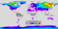 Average Seasonal Temperature Range.png 8,640 × 4,320; 4.37 MB
-
 Daily Temperature Range.png 8,640 × 4,320; 4.3 MB
-
 Day and night land-surface temperatures ESA362940.gif 503 × 688; 94 KB
-
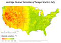 July diurnalvariation US.svg 765 × 549; 14.95 MB
-
 Stratosphere Temperature Trend.jpg 579 × 323; 42 KB


