Category:Maps of provinces of Sweden
Jump to navigation
Jump to search
Subcategories
This category has the following 22 subcategories, out of 22 total.
- Locator maps of provinces of Sweden (104 F)
B
D
- Maps of Dalsland (18 F)
G
H
- Maps of Hälsingland (6 F)
- Maps of Härjedalen (6 F)
J
- Maps of Jämtland (8 F)
L
M
- Maps of Medelpad (15 F)
N
- Maps of Närke (15 F)
S
- Maps of Småland (87 F)
- Maps of Södermanland (53 F)
U
- Maps of Uppland (50 F)
V
Å
Ö
- Maps of Öland (32 F)
Media in category "Maps of provinces of Sweden"
The following 25 files are in this category, out of 25 total.
-
 FC-Provinces of Sweden, clean.png 166 × 363; 5 KB
-
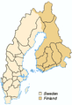
 Historiaj provincoj de Svedio kaj Finnlando.png 275 × 400; 27 KB
-
 Historical provinces of sweden and finland.png 282 × 438; 22 KB
-
 Historical provinces of sweden no national borders.png 275 × 400; 31 KB
-
 Historische Landschaften Schwedens und Finnlands.png 275 × 400; 21 KB
-
 Historiska landskap i Sverige och Finland.png 275 × 400; 28 KB
-
 Map swedish lands bg.png 275 × 400; 12 KB
-
 Provinces of Sweden by population (2016).png 3,900 × 6,690; 1.23 MB
-
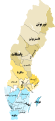
 Provinces of Sweden.png 177 × 377; 5 KB
-
 Sverigekarta-Landskap Text mk.svg 516 × 1,106; 262 KB
-
 Sverigekarta-Landskap Text-fr.svg 500 × 1,091; 84 KB
-
 Sverigekarta-Landskap Text-he.svg 500 × 1,091; 161 KB
-
 Sverigekarta-Landskap Text-pt.svg 500 × 1,091; 82 KB
-
 Sverigekarta-Landskap Text.svg 500 × 1,091; 171 KB
-
 Sverigekarta-Landskap.svg 290 × 660; 72 KB
-
 SverigeLandskapLänKommuner.svg 512 × 1,024; 602 KB
-
 Sveriges landskap farg.svg 512 × 1,179; 61 KB
-
 Sveriges landskap.png 218 × 500; 51 KB
-
 Svpmap blank-es.png 275 × 400; 39 KB
-
 Svpmap blank.png 275 × 400; 40 KB
-
 Sweden provinces and counties overlayed mk.svg 500 × 1,091; 274 KB
-
 Sweden provinces and counties overlayed.svg 500 × 1,091; 224 KB
-
 Историски покраини на Шведска и Финска.png 275 × 400; 42 KB
-
 Провинции Швеции.png 275 × 400; 38 KB
-
 مقاطعات السويد.svg 500 × 1,091; 135 KB


.png)


