Category:Maps of local government areas in Darwin
Jump to navigation
Jump to search
Subcategories
This category has only the following subcategory.
Media in category "Maps of local government areas in Darwin"
The following 9 files are in this category, out of 9 total.
-
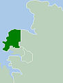
 Darwin city2LGA.png 250 × 327; 13 KB
-
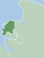
 Darwin cityLGA.JPG 250 × 327; 15 KB
-
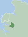
 DarwinLGA.gif 250 × 329; 6 KB
-
 Litchfield Shire LGA.gif 248 × 329; 13 KB
-
 LitchfieldLGA.gif 250 × 329; 6 KB
-
 Map of the Wards and Suburbs of Darwin, Northern Territory.png 3,060 × 3,375; 1.71 MB
-
 Map of the Wards and Suburbs of Darwin, Northern Territory.svg 1,469 × 1,620; 1.54 MB
-
 Palmerston City LGA.gif 248 × 329; 13 KB
-
 PalmerstonLGA.gif 250 × 329; 6 KB


