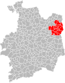
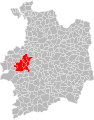
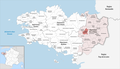
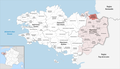
Category:Maps of groups of communes in Ille-et-Vilaine
Jump to navigation
Jump to search
Departments of Metropolitan France: Ain [01] · Aisne [02] · Allier [03] · Alpes-de-Haute-Provence [04] · Hautes-Alpes [05] · Alpes-Maritimes [06] · Ardèche [07] · Ardennes [08] · Ariège [09] · Aube [10] · Aude [11] · Aveyron [12] · Bouches-du-Rhône [13] · Calvados [14] · Cantal [15] · Charente [16] · Charente-Maritime [17] · Cher [18] · Corrèze [19] · Corse-du-Sud [2A]† · Haute-Corse [2B]† · Côte-d’Or [21] · Côtes-d'Armor [22] · Creuse [23] · Dordogne [24] · Doubs [25] · Drôme [26] · Eure [27] · Eure-et-Loir [28] · Finistère [29] · Gard [30] · Haute-Garonne [31] · Gers [32] · Gironde [33] · Hérault [34] · Ille-et-Vilaine [35] · Indre [36] · Indre-et-Loire [37] · Isère [38] · Jura [39] · Landes [40] · Loir-et-Cher [41] · Loire [42] · Haute-Loire [43] · Loire-Atlantique [44] · Loiret [45] · Lot [46] · Lot-et-Garonne [47] · Lozère [48] · Maine-et-Loire [49] · Manche [50] · Marne [51] · Haute-Marne [52] · Mayenne [53] · Meurthe-et-Moselle [54] · Meuse [55] · Morbihan [56] · Moselle [57] · Nièvre [58] · Nord [59] · Oise [60] · Orne [61] · Pas-de-Calais [62] · Puy-de-Dôme [63] · Pyrénées-Atlantiques [64] · Hautes-Pyrénées [65] · Pyrénées-Orientales [66] · Bas-Rhin [67] · Haut-Rhin [68] · departmental district of the Rhône [69] · Rhône [69D]‡ · Haute-Saône [70] · Saône-et-Loire [71] · Sarthe [72] · Savoie [73] · Haute-Savoie [74] · Seine-Maritime [76] · Seine-et-Marne [77] · Yvelines [78] · Deux-Sèvres [79] · Somme [80] · Tarn [81] · Tarn-et-Garonne [82] · Var [83] · Vaucluse [84] · Vendée [85] · Vienne [86] · Haute-Vienne [87] · Vosges [88] · Yonne [89] · Territoire de Belfort [90] · Essonne [91] · Hauts-de-Seine [92] · Seine-Saint-Denis [93] · Val-de-Marne [94] · Val-d'Oise [95]
Overseas departments and regions: Guadeloupe [971] · Martinique [972] · French Guiana [973] · Réunion [974] · Mayotte [976]
Sui generis territories: New Caledonia [988]
Overseas departments and regions: Guadeloupe [971] · Martinique [972] · French Guiana [973] · Réunion [974] · Mayotte [976]
Sui generis territories: New Caledonia [988]
| NO WIKIDATA ID FOUND! Search for Maps of groups of communes in Ille-et-Vilaine on Wikidata | |
| Upload media |
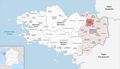
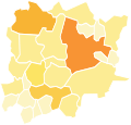
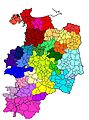
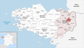
English: Maps of intercommunal cooperation public establishments in the French department of Ille-et-Vilaine.
Français : Cartes des établissements publics de coopération intercommunale (communautés de communes, d’agglomération ou urbaines, métropoles, syndicats intercommunaux) et syndicats mixtes (dont les pôles métropolitains) du département français d’Ille-et-Vilaine.

Subcategories
This category has the following 4 subcategories, out of 4 total.
Media in category "Maps of groups of communes in Ille-et-Vilaine"
The following 116 files are in this category, out of 116 total.
-
 Gemeindeverbände im Département Ille-et-Vilaine 2024.png 3,500 × 2,014; 1.56 MB
-
 35-Ille-et-Vilaine-intercos-2019.png 3,507 × 2,480; 2.38 MB
-
 35-Intercos2019-200038990-Densités.png 3,519 × 2,480; 1.39 MB
-
 35-Intercos2019-200038990.png 3,519 × 2,480; 2.44 MB
-
 35-Intercos2019-200039022-Densités.png 3,519 × 2,480; 2.42 MB
-
 35-Intercos2019-200039022.png 3,519 × 2,480; 4.52 MB
-
 35-Intercos2019-200043990-Densités.png 3,519 × 2,480; 1.49 MB
-
 35-Intercos2019-200043990.png 3,519 × 2,480; 2.78 MB
-
 35-Intercos2019-200070662-Densités.png 3,519 × 2,480; 1.44 MB
-
 35-Intercos2019-200070662.png 3,519 × 2,480; 2.53 MB
-
 35-Intercos2019-200070670-Densités.png 3,519 × 2,480; 1.13 MB
-
 35-Intercos2019-200070670.png 3,519 × 2,480; 2.14 MB
-
 35-Intercos2019-200070688-Densités.png 3,519 × 2,480; 1.32 MB
-
 35-Intercos2019-200070688.png 3,519 × 2,480; 2.42 MB
-
 35-Intercos2019-200072452-Densités.png 3,519 × 2,480; 1.88 MB
-
 35-Intercos2019-200072452.png 3,399 × 2,367; 2.7 MB
-
 35-Intercos2019-243500139-Densités.png 3,519 × 2,480; 2.26 MB
-
 35-Intercos2019-243500139.png 3,519 × 2,480; 4.51 MB
-
 35-Intercos2019-243500550-Densités.png 3,519 × 2,480; 1.08 MB
-
 35-Intercos2019-243500550.png 3,519 × 2,480; 2.11 MB
-
 35-Intercos2019-243500618-Densités.png 3,519 × 2,480; 1.15 MB
-
 35-Intercos2019-243500634-Densités.png 3,519 × 2,480; 1.63 MB
-
 35-Intercos2019-243500634.png 3,519 × 2,480; 2.88 MB
-
 35-Intercos2019-243500659-Densités.png 3,519 × 2,480; 1.16 MB
-
 35-Intercos2019-243500659.png 3,519 × 2,480; 2.6 MB
-
 35-Intercos2019-243500667-Densités.png 3,519 × 2,480; 1.29 MB
-
 35-Intercos2019-243500667.png 3,519 × 2,480; 2.37 MB
-
 35-Intercos2019-243500725-Densités.png 3,519 × 2,480; 1.22 MB
-
 35-Intercos2019-243500725.png 3,519 × 2,480; 2.03 MB
-
 35-Intercos2019-243500733-Densités.png 3,519 × 2,480; 1.51 MB
-
 35-Intercos2019-243500733.png 3,519 × 2,480; 2.71 MB
-
 35-Intercos2019-243500741-Densités.png 3,519 × 2,480; 1.79 MB
-
 35-Intercos2019-243500741.png 3,519 × 2,480; 3.31 MB
-
 35-Intercos2019-243500774-Densités.png 3,519 × 2,480; 1.26 MB
-
 35-Intercos2019-243500774.png 3,519 × 2,480; 2.38 MB
-
 35-Intercos2019-243500782-Densités.png 3,519 × 2,480; 1.48 MB
-
 35-Intercos2019-243500782.png 3,519 × 2,480; 2.75 MB
-
 Gemeindeverband Bretagne Porte de Loire Communauté 2019.png 3,500 × 2,014; 1.5 MB
-
 Gemeindeverband Bretagne Romantique 2019.png 3,500 × 2,014; 1.5 MB
-
 Gemeindeverband Brocéliande 2019.png 3,500 × 2,014; 1.5 MB
-
 CC Bretagne Romantique 01012019.svg 600 × 530; 18 KB
-
 Conseillers communautaires CC Bretagne romantique.svg 438 × 419; 16 KB
-
 Gemeindeverband Couesnon Marches de Bretagne 2019.png 3,500 × 2,014; 1.5 MB
-
 Gemeindeverband Côte d’Émeraude 2023.png 3,500 × 2,014; 1.56 MB
-
 Gemeindeverband Fougères Agglomération 2024.png 3,500 × 2,014; 1.5 MB
-
 Intercommunalités 35.svg 720 × 1,010; 1.02 MB
-
 Intercommunalités Ille-et-Vilaine 2017.svg 507 × 687; 365 KB
-
 Intercommunalités Ille-et-Vilaine 2023.svg 507 × 687; 372 KB
-
 Intercommunalités-d'ille-et-vilaine 01 01 2014.svg 720 × 1,010; 1.68 MB
-
 Intercommunalités-d'ille-et-vilaine 01-01-2010.jpg 1,594 × 2,154; 555 KB
-
 Intercommunalités-d'ille-et-vilaine 01-01-2012.jpg 1,594 × 2,154; 550 KB
-
 Intercommunalités-d'ille-et-vilaine 01-01-2013.jpg 1,594 × 2,154; 549 KB
-
 Intercommunalités-d'ille-et-vilaine 01-07-2012.jpg 1,594 × 2,154; 550 KB
-
 Intercommunalités-d'ille-et-vilaine.jpg 1,594 × 2,154; 551 KB
-
 Gemeindeverband Liffré-Cormier Communauté 2019.png 3,500 × 2,014; 1.5 MB
-
 Localisation CA Fougères agglomération en Ille-et-Vilaine, France.svg 488 × 609; 341 KB
-
 Localisation CA Saint-Malo Agglomération en Ille-et-Vilaine, France.svg 488 × 609; 341 KB
-
 Localisation CA Vitré Communauté en Ille-et-Vilaine, France.svg 488 × 609; 341 KB
-

-
 Localisation CC Bretagne romantique en Ille-et-Vilaine, France.svg 488 × 609; 341 KB
-

-
 Localisation CC de Brocéliande en Ille-et-Vilaine, France.svg 488 × 609; 341 KB
-
 Localisation CC de la Côte d'Émeraude en Ille-et-Vilaine, France.svg 488 × 609; 339 KB
-
 Localisation CC de la Roche-aux-Fées en Ille-et-Vilaine, France.svg 488 × 609; 341 KB
-
 Localisation CC de Saint-Méen Montauban en Ille-et-Vilaine, France.svg 488 × 609; 341 KB
-
 Localisation CC du pays de Châteaugiron en Ille-et-Vilaine, France.svg 488 × 609; 341 KB
-

-
 Localisation CC du pays de Redon en Ille-et-Vilaine, France.svg 507 × 687; 340 KB
-
 Localisation CC du Val d'Ille-Aubigné en Ille-et-Vilaine, France.svg 488 × 609; 341 KB
-
 Localisation CC Liffré-Cormier Communauté en Ille-et-Vilaine, France.svg 488 × 609; 341 KB
-
 Localisation CC Montfort Communauté en Ille-et-Vilaine, France.svg 488 × 609; 341 KB
-

-
 Localisation EPCI Antrain communauté en Ille-et-Vilaine, France.svg 1,000 × 1,275; 144 KB
-
 Localisation EPCI au pays de la Roche aux fées en Ille-et-Vilaine, France.svg 1,000 × 1,275; 144 KB
-
 Localisation EPCI Bretagne romantique en Ille-et-Vilaine, France.svg 556 × 710; 186 KB
-
 Localisation EPCI Coglais communauté marches de Bretagne en Ille-et-Vilaine, France.svg 1,000 × 1,275; 144 KB
-
 Localisation EPCI Côte d'Émeraude en Ille-et-Vilaine, France.svg 1,000 × 1,275; 146 KB
-
 Localisation EPCI de Brocéliande en Ille-et-Vilaine, France.svg 1,000 × 1,275; 144 KB
-
 Localisation EPCI de moyenne Vilaine et Semnon en Ille-et-Vilaine, France.svg 1,000 × 1,275; 144 KB
-
 Localisation EPCI de Saint-Malo Agglomération en Ille-et-Vilaine, France.svg 1,000 × 1,275; 144 KB
-
 Localisation EPCI du canton de Guichen - ACSOR en Ille-et-Vilaine, France.svg 1,000 × 1,275; 144 KB
-
 Localisation EPCI du canton de Pipriac en Ille-et-Vilaine, France.svg 1,000 × 1,275; 144 KB
-
 Localisation EPCI du pays d'Aubigné en Ille-et-Vilaine, France.svg 1,000 × 1,275; 144 KB
-
 Localisation EPCI du pays de Bécherel en Ille-et-Vilaine, France.svg 1,000 × 1,275; 144 KB
-
 Localisation EPCI du pays de Châteaugiron en Ille-et-Vilaine, France.svg 1,000 × 1,275; 144 KB
-

-
 Localisation EPCI du pays de Liffré en Ille-et-Vilaine, France.svg 1,000 × 1,275; 144 KB
-
 Localisation EPCI du pays de Montauban-de-Bretagne en Ille-et-Vilaine, France.svg 1,000 × 1,275; 144 KB
-
 Localisation EPCI du pays de Redon en Ille-et-Vilaine, France.svg 1,009 × 1,425; 210 KB
-
 Localisation EPCI du pays de Saint-Aubin-du-Cormier en Ille-et-Vilaine, France.svg 1,000 × 1,275; 144 KB
-
 Localisation EPCI du pays de Saint-Méen-le-Grand en Ille-et-Vilaine, France.svg 1,000 × 1,275; 144 KB
-
 Localisation EPCI du pays du Grand-Fougeray en Ille-et-Vilaine, France.svg 1,000 × 1,275; 144 KB
-
 Localisation EPCI du pays guerchais en Ille-et-Vilaine, France.svg 1,000 × 1,275; 144 KB
-
 Localisation EPCI du val d'Ille en Ille-et-Vilaine, France.svg 1,000 × 1,275; 144 KB
-
 Localisation EPCI Fougères communauté en Ille-et-Vilaine, France.svg 1,000 × 1,275; 144 KB
-
 Localisation EPCI Louvigné communauté en Ille-et-Vilaine, France.svg 1,000 × 1,275; 144 KB
-
 Localisation EPCI Maure-de-Bretagne communauté en Ille-et-Vilaine, France.svg 1,000 × 1,275; 144 KB
-
 Localisation EPCI Montfort communauté en Ille-et-Vilaine, France.svg 1,000 × 1,275; 144 KB
-

-
 Localisation EPCI Rennes Métropole en Ille-et-Vilaine, France.svg 1,000 × 1,275; 137 KB
-
 Localisation EPCI Saint-Méen Montauban Ille-et-Vilaine, France.svg 580 × 740; 198 KB
-
 Localisation EPCI Vallons de Haut-Bretagne Ille-et-Vilaine, France.svg 580 × 740; 191 KB
-
 Localisation EPCI Vitré communauté en Ille-et-Vilaine, France.svg 1,000 × 1,275; 145 KB
-
 Localisation Rennes Métropole en Ille-et-Vilaine, France.svg 488 × 609; 341 KB
-
 Gemeindeverband Montfort Communauté 2019.png 3,500 × 2,014; 1.5 MB
-
 Gemeindeverband Pays de Châteaugiron Communauté 2019.png 3,500 × 2,014; 1.5 MB
-
 Gemeindeverband Pays de Dol et de la Baie du Mont Saint-Michel 2019.png 3,500 × 2,014; 1.5 MB
-
 Gemeindeverband Pays de Saint-Malo Agglomération 2023.png 3,500 × 2,014; 1.51 MB
-
 Gemeindeverband Redon Agglomération - Bretagne 2019.png 3,500 × 2,014; 1.52 MB
-
 Rennes District 1970.svg 464 × 344; 40 KB
-
 Gemeindeverband Rennes Métropole 2019.png 3,500 × 2,014; 1.5 MB
-
 Gemeindeverband Roche aux Fées 2023.png 3,500 × 2,014; 1.51 MB
-
 Gemeindeverband Saint-Méen Montauban 2019.png 3,500 × 2,014; 1.5 MB
-
 Gemeindeverband Val d’Ille-Aubigné 2019.png 3,500 × 2,014; 1.5 MB
-
 Gemeindeverband Vallons de Haute-Bretagne Communauté 2019.png 3,500 × 2,014; 1.5 MB
-
 Gemeindeverband Vitré Communauté 2019.png 3,500 × 2,014; 1.5 MB


