Category:Maps of geologic formations in New Mexico
Jump to navigation
Jump to search
Media in category "Maps of geologic formations in New Mexico"
The following 10 files are in this category, out of 10 total.
-
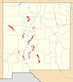 Abo Formation exposure map.jpg 400 × 450; 38 KB
-
 Arroyo Penasco outcrop map.jpg 400 × 450; 31 KB
-
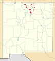
 Bandelier Tuff map.jpg 400 × 450; 32 KB
-
 Caballero Formation outcrop map.jpg 1,245 × 1,401; 163 KB
-
 Glorieta Formation outcrop map.jpg 400 × 450; 43 KB
-
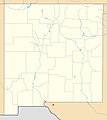
 Hondo Group outcrop map.jpg 400 × 450; 33 KB
-
 La Tuna Map.jpg 1,245 × 1,401; 158 KB
-
 Summerville Formation map.jpg 768 × 852; 91 KB
-
 Vadito Group outcrop map.jpg 400 × 450; 33 KB
-
 Yeso Formation exposure map.jpg 400 × 450; 50 KB


