Category:Maps of forests in the United States
Jump to navigation
Jump to search
Media in category "Maps of forests in the United States"
The following 38 files are in this category, out of 38 total.
-
12051 Forest Dynamics UHD.webm 3 min 58 s, 3,840 × 2,160; 783.74 MB
-
 Appalachian mixed mesophytic forests map.svg 1,712 × 1,992; 342 KB
-
 Appalachian-Blue Ridge forests map.svg 1,712 × 1,992; 343 KB
-
 Appalachian-spruce-fir-zones.png 390 × 252; 5 KB
-
 Arizona Mountains Forests map.svg 1,712 × 1,992; 342 KB
-
 Atlantic coastal pine barrens map.svg 1,712 × 1,992; 338 KB
-
 Buchanan state park.png 1,024 × 784; 340 KB
-

-
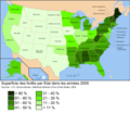 Carte forets percent USA 2008.png 4,000 × 3,469; 1.42 MB
-
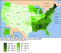 Carte forets USA 2009.png 3,000 × 2,602; 1.02 MB
-
 Carte forets USA pour cent 2009.png 3,000 × 2,602; 907 KB
-
 Carte forêts usa 2009.svg 957 × 830; 364 KB
-
 Cascade Mountains leeward forests map.svg 1,712 × 1,992; 338 KB
-
 Central Forests-Grassland Transition Zone map.svg 1,712 × 1,992; 346 KB
-
 Central Pacific coastal forests map.svg 1,712 × 1,992; 337 KB
-
 Central U.S. Hardwood Forests map.svg 1,712 × 1,992; 345 KB
-
 Contus treecanopy lrg.png 2,141 × 1,618; 1.87 MB
-
 Cornplanter.png 1,024 × 784; 151 KB
-
 Eastern Cascades Forests map.svg 1,712 × 1,992; 338 KB
-
 Eastern forest-boreal transition map.svg 1,712 × 1,992; 339 KB
-
 EB1911 Forests and Forestry - forest regions of the U.S.jpg 1,072 × 679; 360 KB
-
 Forest Cover of US States.png 5,400 × 3,586; 1.46 MB
-

-

-
 Great Basin Montane Forests map.svg 1,712 × 1,992; 181 KB
-

-
 Madrean Sky Islands Montane Forests map.svg 1,712 × 1,992; 345 KB
-
 Middle Atlantic coastal forests map.svg 1,712 × 1,992; 341 KB
-
 Biomes Minnesota.tiff 612 × 699; 1.22 MB
-
 New England-Acadian forests map.svg 1,712 × 1,992; 346 KB
-
 NIE 1906 Forestry - Forests in the U.S.png 1,825 × 1,148; 273 KB
-
 North Central Rockies forests map.svg 1,712 × 1,992; 341 KB
-
 North Woods.gif 720 × 480; 17 KB
-
 Northeastern coastal forests map.svg 1,712 × 1,992; 343 KB
-
 Ozark Mountain Forests map.svg 1,712 × 1,992; 336 KB
-
 PSM V63 D378 Forest map of the usa.png 1,622 × 991; 287 KB
-
 PSM V82 D445 Distribution of forests in western united states.png 1,648 × 1,963; 701 KB
-
 Wildland Fire in Ecosystems 15-1-2.png 1,804 × 1,396; 1.43 MB


_(20580766851).jpg)


%27_(16402977688).jpg)


