Category:Maps of ancient Anatolia
Jump to navigation
Jump to search
English: Maps of ancient Anatolia. Anatolia is a geographic region bounded by the Black Sea to the north, the Mediterranean Sea to the south, the Aegean Sea to the west, and the bulk of the Asian mainland to the east. Anatolia comprises most of modern Turkey.
Subcategories
This category has the following 27 subcategories, out of 27 total.
A
- Maps of Aeolis (5 F)
- Asie mineure - btv1b84397626 (3 F)
B
C
- Maps of Commagene (53 F)
- Maps of Corduene (49 F)
H
- Maps of the Hattians (4 F)
I
L
- Maps of Lydia (97 F)
M
- Maps of Mysia (23 F)
O
- Maps of Osrhoene (63 F)
P
- Maps of Pergamon (26 F)
- Ptolemy's 1st Asian Map (67 F)
R
S
- Maps of Sophene (46 F)
- Maps of Syro-Hittite states (15 F)
T
- Treaty of Apamea (9 F)
- Maps of Troas (30 F)
U
Media in category "Maps of ancient Anatolia"
The following 101 files are in this category, out of 101 total.
-
Anatolia 264.jpg 823 × 513; 191 KB
-
Map of Greece, Archipelago and part of Anadoli; Louis Stanislas d'Arcy Delarochette 1791.jpg 9,411 × 6,605; 15.99 MB
-
Af Western Asia Minor Greek Colonization af.svg 744 × 1,052; 809 KB
-
Alter Orient 1800BC.svg 2,102 × 1,510; 4.8 MB
-
Alter Orient 1900BC.svg 2,102 × 1,510; 4.91 MB
-
Alter Orient 2000BC.svg 2,102 × 1,510; 4.84 MB
-
Alter Orient 2100BC.svg 2,102 × 1,510; 4.84 MB
-
Alter Orient 2200BC.svg 2,102 × 1,510; 4.84 MB
-
Alter Orient 2300BC.svg 2,102 × 1,510; 4.65 MB
-
Anatolia Ancient Regions ID.png 800 × 518; 95 KB
-
AnatoliaAncientRegions.png 800 × 518; 75 KB
-
Anatolian peoples in 1st millennium BC.jpg 568 × 379; 33 KB
-
Anatòlia Edat de Bronze.png 800 × 857; 82 KB
-
Anatólia nyári legelői.png 1,128 × 773; 1.25 MB
-
Ancient Anatolia nor.png 2,685 × 2,232; 3.85 MB
-
Ancient edremit gulf.jpg 870 × 448; 54 KB
-
Ancient Near East 1800BC.svg 2,102 × 1,510; 4.79 MB
-
Ancient Near East 1900BC.svg 2,102 × 1,510; 4.89 MB
-
Ancient Near East 2000BC.svg 2,102 × 1,510; 4.83 MB
-
Ancient Near East 2200BC.svg 2,102 × 1,510; 4.83 MB
-
Ancient Near East 2300BC.svg 2,102 × 1,510; 4.65 MB
-
Antic Anatolia.jpg 805 × 348; 265 KB
-
Antikamindreasien.png 800 × 518; 72 KB
-
Antoine Philippe Houze. L'Empire des Perses. 1844 (D).jpg 1,675 × 902; 278 KB
-
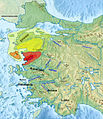
Arzawa be.png 996 × 781; 926 KB
-
Asia Minor - Armenia Minor.jpg 6,167 × 4,027; 7.21 MB
-
Asia Minor in the Greco-Roman period - general map - regions and main settlements.jpg 6,167 × 4,027; 8.56 MB
-
Asia Minor in the Greco-Roman period-zh.svg 1,850 × 1,206; 2.43 MB
-
Asia minor p20.jpg 2,313 × 1,525; 1.07 MB
-
Asia minor-Shepherd 1923.JPG 2,223 × 1,500; 350 KB
-
Asiaminorhistory.jpg 560 × 345; 224 KB
-
Brue, Adrien Hubert, Asie-Mineure, Armenie, Syrie, Mesopotamie, Caucase. 1839. (E).jpg 2,063 × 1,033; 886 KB
-
Brue, Adrien Hubert, Asie-Mineure, Armenie, Syrie, Mesopotamie, Caucase. 1839. (EC).jpg 1,015 × 1,033; 449 KB
-
C+B-Galatia-Map.JPG 1,643 × 1,216; 630 KB
-
Carte Bithynie.png 483 × 444; 55 KB
-
Carte Carie-he.png 483 × 444; 52 KB
-
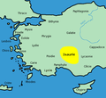
Carte Isaurie-es.svg 2,137 × 1,459; 2.89 MB
-
Carte Isaurie.png 483 × 444; 56 KB
-
Carte Lycaonie.png 483 × 444; 56 KB
-
Carte Paphlagonie.png 483 × 444; 54 KB
-
Carte Pisidie.png 483 × 444; 57 KB
-
Classical antiquity historical territory of Minor Asia (ru).jpg 483 × 444; 43 KB
-
Culture ceramiche del Vicino Oriente nel medio Halaf - 5200-4500 a.C.jpg 3,820 × 2,900; 1.06 MB
-
Elaioussa-Sebaste.JPG 644 × 473; 86 KB
-
Hattic-language-rus.png 3,502 × 2,460; 656 KB
-
Heinrich Kiepert. Asia citerior.Lycaonia.jpg 1,055 × 1,024; 238 KB
-
LangThraco-Illyri.png 636 × 509; 88 KB
-
Luvianoj.svg 868 × 528; 1.98 MB
-
Luwiya.svg 868 × 528; 1.98 MB
-
Lycia locator map.svg 921 × 596; 198 KB
-
Map Anatolia ancient regions (Indonesian version).svg 921 × 596; 278 KB
-
Map Anatolia ancient regions-af.jpg 914 × 593; 105 KB
-
Map Anatolia ancient regions-el.svg 921 × 596; 278 KB
-
Map Anatolia ancient regions-en.svg 921 × 596; 256 KB
-
Map Anatolia ancient regions-es.svg 921 × 596; 184 KB
-
Map Anatolia ancient regions-hu.svg 921 × 596; 234 KB
-
Map Anatolia ancient regions-it.svg 921 × 596; 276 KB
-
Map Anatolia ancient regions-pt.svg 921 × 596; 278 KB
-
Map Anatolia ancient regions-ru.png 800 × 517; 92 KB
-
Map Anatolia ancient regions-ru.svg 921 × 596; 278 KB
-
Map Anatolia ancient regions-sl.svg 921 × 596; 274 KB
-
Map Anatolia ancient regions-tr.svg 921 × 596; 276 KB
-
Map Anatolia ancient regions-uk.svg 921 × 596; 276 KB
-
Map Anatolia ancient regions-zh.svg 1,151 × 745; 67 KB
-
Map Anatolia-fr draft.svg 790 × 638; 288 KB
-
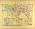
Map of the Ancient Near East.jpg 3,540 × 2,938; 2.34 MB
-
Middle East topographic map-blank 3000bc crop.svg 1,426 × 1,083; 10.01 MB
-
Near East topographic map with toponyms 3000bc-pt.svg 1,426 × 1,083; 10.04 MB
-
Near East topographic map with toponyms 3000bc.svg 1,426 × 1,083; 10.04 MB
-
Neolitico ceramico, calcolitico e bronzo antico nel Vicino Oriente.jpg 3,814 × 2,900; 1.31 MB
-
Political map of Asia Minor in 500 BC in Masry.PNG 800 × 518; 65 KB
-
RegionesDeAsiaMenor.svg 2,137 × 1,459; 2.88 MB
-
Reiaume de Pònt durant lo rèine de Mitridat VI.png 1,072 × 1,035; 230 KB
-
Robert de Vaugondy. Map of the Early Ages of the World. 1762.jpg 807 × 800; 231 KB
-
Roman East 50 CE Commagene highlighted-en.svg 2,717 × 1,595; 854 KB
-
Roman East 50 CE Commagene highlighted-zh.svg 3,396 × 1,993; 2.7 MB
-
Roman East 50-ang.svg 2,717 × 1,595; 822 KB
-
Roman East 50-en.svg 2,717 × 1,595; 848 KB
-
Roman East 50-es.svg 2,717 × 1,595; 3.6 MB
-
Roman East 50-fi.svg 2,717 × 1,595; 854 KB
-
Roman East 50-he.svg 2,717 × 1,595; 854 KB
-
Roman East 50-hu.svg 2,717 × 1,595; 858 KB
-
Roman East 50-it.svg 2,717 × 1,595; 857 KB
-
Roman East 50-pt.svg 2,717 × 1,595; 851 KB
-
Roman East 50-zh.svg 3,396 × 1,993; 2.68 MB
-
Siti neolitici del Vicino Oriente.jpg 4,425 × 2,900; 1.14 MB
-
Szeha.jpg 1,158 × 1,343; 1.42 MB
-
Térkép Tudhalijasz és Arnuvandasz koráról.png 2,000 × 947; 2.15 MB
-
Vilusza.jpg 1,158 × 1,343; 1.41 MB
-
Мисия Лидия Кария Ликия Иония.png 2,132 × 2,276; 1.32 MB
-
Харран (2).svg 2,260 × 1,183; 1.64 MB
-
مناطق آناتولی باستان.svg 921 × 596; 278 KB


