Category:Maps of World War II in Europe 1942
Jump to navigation
Jump to search
Media in category "Maps of World War II in Europe 1942"
The following 55 files are in this category, out of 55 total.
-
 1942 Japanese map of the Mediterranean during World War II.tif 10,588 × 4,343; 131.58 MB
-
 Armee-Abteilungen dispositons.jpg 1,073 × 1,087; 158 KB
-
 Auchwitz Europe 12 1942 en crop.svg 1,070 × 761; 1.17 MB
-
 Auschwitz Europe 12 1942 en.svg 1,070 × 761; 1.21 MB
-
 Axis Occupation of Europe (1942).svg 450 × 456; 483 KB
-
 Europe WWII 1942 locator map - Serbia.PNG 250 × 115; 6 KB
-
 Europe WWII 1942 locator map.PNG 250 × 115; 6 KB
-
 German Reich 1942 (11–19 November).svg 450 × 456; 586 KB
-
 German Reich 1942 (no occupations).svg 450 × 456; 500 KB
-
 German Reich 1942.png 450 × 456; 65 KB
-
 German Reich 1942.svg 450 × 456; 489 KB
-
 Greater German Reich in 1942 (1).png 1,837 × 1,655; 179 KB
-
 Map of the first phase of Operation Sportpalast.jpg 800 × 1,230; 248 KB
-
 Map of the second phase of Operation Sportpalast.jpg 800 × 1,238; 241 KB
-
 Moscow and Vicinity 1942.jpg 732 × 690; 459 KB
-
 Operatie Fridericus II.jpg 1,275 × 1,131; 564 KB
-
 Operatie Wilhelm.jpg 1,210 × 1,131; 527 KB
-
 Second World War Europe 01 1942 de.png 1,520 × 1,340; 1.03 MB
-
 Second World War Europe 01 1942 de.svg 1,520 × 1,340; 1.06 MB
-
 Second World War Europe 01 1942 es.svg 1,520 × 1,340; 1.08 MB
-
 Second World War Europe 02 1942 de.png 1,520 × 1,340; 1.03 MB
-
 Second World War Europe 02 1942 de.svg 1,520 × 1,340; 1.06 MB
-
 Second World War Europe 03 1942 de.png 1,520 × 1,340; 1.03 MB
-
 Second World War Europe 03 1942 de.svg 1,520 × 1,340; 1.08 MB
-
 Second World War Europe 04 1942 de.png 1,520 × 1,340; 1.03 MB
-
 Second World War Europe 04 1942 de.svg 1,520 × 1,340; 1.06 MB
-
 Second World War Europe 05 1942 de.png 1,520 × 1,340; 1.03 MB
-
 Second World War Europe 05 1942 de.svg 1,520 × 1,340; 1.06 MB
-
 Second World War Europe 06 1942 de.png 1,520 × 1,340; 1.03 MB
-
 Second World War Europe 06 1942 de.svg 1,520 × 1,340; 1.06 MB
-
 Second World War Europe 07 1942 de.png 1,520 × 1,340; 1.03 MB
-
 Second World War Europe 07 1942 de.svg 1,520 × 1,340; 1.06 MB
-
 Second World War Europe 08 1942 de.png 1,520 × 1,340; 1.03 MB
-
 Second World War Europe 08 1942 de.svg 1,520 × 1,340; 1.06 MB
-
 Second World War Europe 09 1942 de.png 1,520 × 1,340; 1.03 MB
-
 Second World War Europe 09 1942 de.svg 1,520 × 1,340; 1.06 MB
-
 Second World War Europe 10 1942 de.png 1,520 × 1,340; 1.03 MB
-
 Second World War Europe 10 1942 de.svg 1,520 × 1,340; 1.06 MB
-
 Second World War Europe 11 1942 de.png 1,520 × 1,340; 1.03 MB
-
 Second World War Europe 11 1942 de.svg 1,520 × 1,340; 1.06 MB
-
 Second World War Europe 11 1942 es.svg 1,520 × 1,340; 1.08 MB
-
 Second World War Europe 12 1942 de.png 1,520 × 1,340; 1.03 MB
-
 Second World War Europe 12 1942 de.svg 1,520 × 1,340; 1.06 MB
-
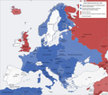
 Second world war europe 1941-1942 map en.png 1,090 × 1,000; 216 KB
-
 Second world war europe 1941-1942 map hy.png 1,090 × 1,000; 478 KB
-
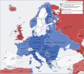
 Second world war europe 1941-1942 map pl.png 1,090 × 1,000; 445 KB
-
 Second world war europe 1941-1942 map pl2.png 1,090 × 1,000; 236 KB
-
 Second world war europe 1941-1942 map tr.png 1,083 × 989; 220 KB
-
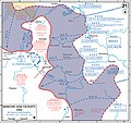
 Soviet Winter Offensive, 6 December 1941 -7 May 1942.jpg 890 × 689; 773 KB
-
 Ubersichtsplan der Stadt Riga - NARA - 50926096.jpg 8,416 × 6,663; 14.17 MB
-
 Wilhelm-Fridericus II.jpg 810 × 992; 1.45 MB
-
 World War II 1942.jpg 1,088 × 998; 791 KB
-
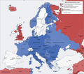
 WWII Europe 1941-1942 Map EN.png 1,090 × 1,000; 99 KB
-
 Битва за Ленинград.png 6,250 × 4,042; 1.09 MB
-
 欧洲局势 1941-1942.png 1,090 × 1,000; 341 KB


.svg)


.svg)
.svg)


.png)


