Category:Maps of Vitry-le-François
Jump to navigation
Jump to search
Français : Cartes de Vitry-le-François
Wikimedia category | |||||
| Upload media | |||||
| Instance of | |||||
|---|---|---|---|---|---|
| Category combines topics | |||||
| Vitry-le-François | |||||
commune in Marne, France .JPG)   | |||||
| Instance of | |||||
| Named after | |||||
| Location |
| ||||
| Located in or next to body of water | |||||
| Head of government | |||||
| Population |
| ||||
| Area |
| ||||
| Elevation above sea level |
| ||||
| Different from | |||||
| official website | |||||
 | |||||
Media in category "Maps of Vitry-le-François"
The following 23 files are in this category, out of 23 total.
-
 51352-Marolles-Sols.png 3,270 × 2,598; 1.82 MB
-
 51649-Vitry-le-François-Hydro.jpeg 5,846 × 4,133; 2.4 MB
-
 51649-Vitry-le-François-Sols.png 3,270 × 2,598; 3.1 MB
-
 Aire urbaine densité vitry.png 319 × 249; 8 KB
-
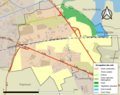
 Arrondissement de Vitry-le-François.PNG 409 × 471; 14 KB
-
 B-514546101 Aff 0000CP566 0 00001 p.jpg 2,629 × 2,137; 1.79 MB
-
 Canton-Vitry-Est.svg 75 × 115; 20 KB
-
 Canton-Vitry-Ouest.svg 85 × 88; 15 KB
-
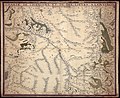
 Cassini-Vitry-le-François.png 754 × 440; 747 KB
-
 Chastillon C 1006469 vitry.jpg 1,836 × 1,272; 709 KB
-
 Chastillon C 1006470 vitry.jpg 1,804 × 1,199; 668 KB
-
 Map commune FR insee code 51649.png 756 × 605; 49 KB
-
 Plan cité scolaire FrançoisIer.jpg 2,916 × 1,972; 550 KB
-
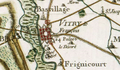
 Plan de vitry 1002245.jpg 3,052 × 2,144; 1.16 MB
-
 Plan de Vitry-le-François cité scolaire FrançoisIer.png 736 × 582; 119 KB
-
 Plan de Vitry-le-François(OSM).png 1,722 × 2,104; 2.33 MB
-
 Plan de Vitry-le-François.png 736 × 582; 211 KB
-
 Vitry 1795 10516.jpg 1,227 × 1,638; 315 KB
-
 Vitry 1893 Atlas Cantonal.jpg 7,039 × 5,606; 6 MB
-
 Vitry hydrographie 01972.jpg 2,657 × 2,717; 1.35 MB
-
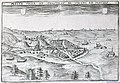
 Vitry le françois zeiller 13664.jpg 3,048 × 1,400; 2.7 MB
-
 Vitry-le-François 1101967.jpg 3,748 × 1,824; 725 KB
-
 Vitry-le-François.PNG 331 × 225; 188 KB


.png)


