Category:Maps of Tempelhof-Schöneberg
Jump to navigation
Jump to search
Subcategories
This category has the following 6 subcategories, out of 6 total.
F
- Maps of Berlin-Friedenau (6 F)
L
- Maps of Berlin-Lichtenrade (5 F)
M
- Maps of Berlin-Mariendorf (8 F)
- Maps of Berlin-Marienfelde (4 F)
S
- Maps of Berlin-Schöneberg (16 F)
T
- Maps of Berlin-Tempelhof (7 F)
Media in category "Maps of Tempelhof-Schöneberg"
The following 9 files are in this category, out of 9 total.
-
 Berlin Tempelhof-Schoeneberg.png 479 × 703; 46 KB
-
 Berlin tempelhof-schöneberg.png 800 × 643; 48 KB
-
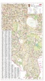 Bezirkskarte Tempelhof-Schöneberg 10k farbe 2015.pdf 5,314 × 9,447; 20.09 MB
-
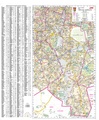
 Bezirkskarte Tempelhof-Schöneberg 10k sw 2015.pdf 5,314 × 9,447; 19.32 MB
-
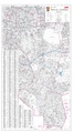
 Bezirkskarte Tempelhof-Schöneberg 20k farb 2015.pdf 3,895 × 4,722; 18.17 MB
-
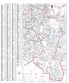 Bezirkskarte Tempelhof-Schöneberg 20k sw 2015.pdf 3,895 × 4,722; 17.88 MB
-
 Karte Kleistpark.png 714 × 723; 272 KB
-
 MercureHotelTempelhofSurroundingsMap.png 1,413 × 792; 559 KB
-
 Teltower Kreisbahnen Netzplan.png 5,917 × 2,389; 9.82 MB


