Category:Maps of São Miguel (Azores)
Jump to navigation
Jump to search
Subcategories
This category has the following 6 subcategories, out of 6 total.
L
N
P
R
V
Media in category "Maps of São Miguel (Azores)"
The following 11 files are in this category, out of 11 total.
-
 Admiralty Chart No 1854 Azores San Miguel, Published 1849.jpg 8,312 × 5,860; 6.11 MB
-
 Azores-StMichael1845.jpg 851 × 1,539; 227 KB
-
 Locator map Azores São Miguel.png 1,574 × 978; 57 KB
-
 PNAI SMiguel.png 2,591 × 1,528; 146 KB
-
 San-migel.PNG 712 × 384; 81 KB
-
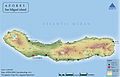 Sao Miguel Physical map.jpg 9,007 × 5,776; 9.02 MB
-
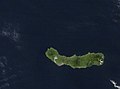 Sao Miguel satellite photo-NASA.jpg 515 × 384; 19 KB
-
 Sao Miguel-pos.png 2,724 × 1,663; 189 KB
-
 São Miguel karta.JPG 304 × 171; 10 KB
-
 São Miguel map be.svg 886 × 709; 61 KB
-
 São Miguel, Azores (Açores) Archipelago, Portugal (49024888471).jpg 3,024 × 3,385; 4.54 MB


_Archipelago,_Portugal_(49024888471).jpg)