Category:Maps of Opsterland
Jump to navigation
Jump to search
Wikimedia category | |||||
| Upload media | |||||
| Instance of | |||||
|---|---|---|---|---|---|
| Category combines topics | |||||
| Opsterland | |||||
municipality in Friesland, the Netherlands      | |||||
| Instance of |
| ||||
| Location | Friesland, Netherlands | ||||
| Population |
| ||||
| Area |
| ||||
| Elevation above sea level |
| ||||
| official website | |||||
 | |||||
Subcategories
This category has only the following subcategory.
Media in category "Maps of Opsterland"
The following 21 files are in this category, out of 21 total.
-
 2013-Opsterland.jpg 4,596 × 3,349; 9.1 MB
-
 Gem-Opsterland-2014Q1.jpg 9,152 × 6,531; 24.08 MB
-
 Gem-Opsterland-OpenTopo.jpg 9,257 × 6,450; 6.87 MB
-
 Map - NL - Opsterland (2009).svg 625 × 575; 2.12 MB
-
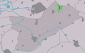
 Map NL Opsterlân Bakkefean.png 800 × 500; 82 KB
-
 Map NL Opsterlân Beetstersweach.png 800 × 500; 83 KB
-
 Map NL Opsterlân De Gordyk.png 800 × 500; 83 KB
-
 Map NL Opsterlân De Himrik.png 800 × 500; 83 KB
-
 Map NL Opsterlân Fryske Peallen.png 800 × 500; 82 KB
-
 Map NL Opsterlân Langsweagen.png 800 × 500; 82 KB
-
 Map NL Opsterlân Lippenhuzen.png 800 × 500; 82 KB
-
 Map NL Opsterlân Lúkswâld.png 800 × 500; 82 KB
-
 Map NL Opsterlân Nij Beets.png 800 × 500; 82 KB
-
 Map NL Opsterlân Oerterp.png 800 × 500; 83 KB
-
 Map NL Opsterlân Olterterp.png 800 × 500; 82 KB
-
 Map NL Opsterlân Sigerswâld.png 800 × 500; 82 KB
-
 Map NL Opsterlân Terwispel.png 800 × 500; 83 KB
-
 Map NL Opsterlân Tynje.png 800 × 500; 82 KB
-
 Map NL Opsterlân Wynjewâld.png 800 × 500; 83 KB
-
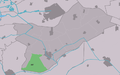
 Opsterland location map municipality NL.png 760 × 598; 100 KB
-
 Wijnjeterper Schar.jpg 1,239 × 788; 175 KB


.svg)


