Category:Maps of Novaya Zemlya
Jump to navigation
Jump to search
Wikimedia category | |||||
| Upload media | |||||
| Instance of | |||||
|---|---|---|---|---|---|
| Category combines topics | |||||
| Novaya Zemlya | |||||
Arctic archipelago in northern Russia  | |||||
| Instance of |
| ||||
| Location | Arkhangelsk Oblast, Russia | ||||
| Located in or next to body of water | |||||
| Has part(s) | |||||
| Area |
| ||||
| Elevation above sea level |
| ||||
| Different from | |||||
 | |||||
Subcategories
This category has the following 2 subcategories, out of 2 total.
C
- Carte de la Tartarie (1706) (10 F)
S
Media in category "Maps of Novaya Zemlya"
The following 88 files are in this category, out of 88 total.
-
 "Nova Zemla." (22240827922).jpg 3,558 × 2,713; 1.29 MB
-
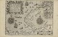
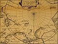
 1598 map of the Polar Regions by Willem Barentsz.jpg 13,719 × 10,160; 30.66 MB
-

-
 Delisle - L'Asie.jpg 3,672 × 2,872; 9.08 MB
-

-

-
 Map of Asia in 1700 by Guillaume de L'Isle.jpg 7,647 × 5,826; 13.98 MB
-
 173 of 'Adventurous Boat Voyages, etc' (11172828755).jpg 1,271 × 1,981; 523 KB
-
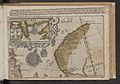
 1766 map - Carte de Tartarie dressee sur les relations.jpg 15,735 × 12,102; 42.68 MB
-
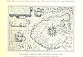
 JONGE(1873) p049 Maps of Nova Zembla island.jpg 3,255 × 1,828; 3.55 MB
-
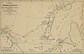
 VEER(1873) p057 Map of the Barents-Expedition in1596-97.jpg 4,919 × 2,890; 3.45 MB
-
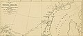
 JONGE(1877) p042 Map of NOVAYA SEMLYA.jpg 4,101 × 4,561; 3.1 MB
-
-
-

-
-
 Admiralty Chart No 2282 Arctic Ocean and Greenland Sea, Published 1872.jpg 15,062 × 12,375; 19.49 MB
-
 Arctic archipelago of Novaya Zemlya (in Bulgarian).png 1,544 × 1,996; 64 KB
-
 Arh density.png 6,000 × 4,986; 1.08 MB
-
 Atlas van Loon Nova Zemla.jpg 3,040 × 2,335; 5.02 MB
-
 Ausschnitt Scheda-Insel aus JONGE(1877) p042 Map of NOVAYA SEMLYA.jpg 251 × 192; 115 KB
-
 Barents third voyage.jpg 2,000 × 1,511; 965 KB
-
 Barentskartet, 1598 (12068020364).jpg 2,842 × 2,091; 3.85 MB
-
 Barentsz arctic map.jpg 650 × 517; 102 KB
-
 Barentsz Full Map.jpg 1,000 × 742; 258 KB
-
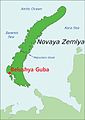 Belushya Guba on map of Novaya Zemlya.jpg 1,000 × 1,408; 149 KB
-

-

-
 Carte Nouvelle-Zemble.jpg 6,705 × 5,161; 4.16 MB
-
 Cute Stuff in North (3779649865).jpg 1,280 × 960; 179 KB
-
 EPNZ 1-3 oil and gas areas.png 743 × 653; 237 KB
-
 Forminsket utgave av Barentskartet - no-nb krt 00487.jpg 4,418 × 3,449; 3.45 MB
-
 India Orientalis - no-nb digibok 2013101026001-314.jpg 4,662 × 2,949; 2.38 MB
-

-

-
 Kaart van Nova Zembla, 1594, NG-1979-564-2.jpg 3,502 × 4,144; 2.66 MB
-
 Kaart van Nova Zembla, 1594, RP-P-OB-80.197.jpg 4,840 × 3,940; 2.05 MB
-

-
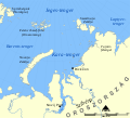 Kara Sea map hu.svg 1,256 × 1,144; 349 KB
-
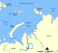
 Kara Sea map RU.png 952 × 868; 323 KB
-
 Kara Sea map.png 942 × 858; 258 KB
-
 Kara seaMZ.PNG 710 × 534; 18 KB
-
 Karte nowaja semlja.png 514 × 774; 10 KB
-
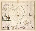
 Map of Nova Zembla, 1683.jpg 768 × 1,024; 106 KB
-
 Map of Nova Zembla, 1719.jpg 851 × 1,021; 167 KB
-
 May19zemble.JPG 377 × 247; 24 KB
-
 Mount Kruzenshtern - 1872 Admiralty Chart.png 1,176 × 558; 1.31 MB
-

-
 Mount Kruzenshtern-JONGE(1873) p049.jpg 1,005 × 656; 190 KB
-
 Mount Kruzenshtern-NORDENSKIÖLD(1877) p117.jpg 1,072 × 609; 168 KB
-
 Mt Kruzenshtern -Carte Nouvelle-Zemble.jpg 967 × 580; 193 KB
-
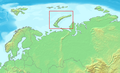
 Nouvelle Zemble position.png 329 × 330; 36 KB
-
 Nouvelle-Zemble (Yuzhny Island).png 4,531 × 6,140; 37.22 MB
-
 Nova Zembla.png 329 × 330; 25 KB
-
 Novaja Zemlja.png 426 × 600; 58 KB
-
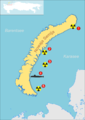
 Novaya Zemlya Archipelago.png 1,544 × 1,996; 63 KB
-
 Novaya Zemlya Hindi.png 450 × 634; 48 KB
-
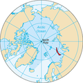
 Novaya Zemlya position zh.png 329 × 330; 38 KB
-
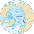
 Novaya Zemlya position.png 329 × 330; 34 KB
-
 Novaya Zemlya testing map 5.jpg 1,152 × 2,500; 748 KB
-
 Novaya Zemlya testing map.png 1,152 × 1,692; 2.27 MB
-
 Novaya Zemlya.af.svg 448 × 631; 10 KB
-
 Novaya Zemlya.png 425 × 599; 49 KB
-
 Novazembla.jpg 1,070 × 746; 244 KB
-
 Noordtoost cust van Asia, van Japan tot Nova Zemla (NYPL b13908778-1619046).jpg 5,472 × 4,632; 6.33 MB
-
 Operational Navigation Chart B-2, 3rd edition.jpg 9,254 × 6,716; 13.42 MB
-
 Operational Navigation Chart C-3, 6th edition.jpg 9,106 × 6,653; 15.26 MB
-
 Pechora sea4NZ.PNG 710 × 534; 18 KB
-
 Pontanus 1611 Arctic Map.jpg 2,852 × 2,142; 802 KB
-
 Relief Map of Novaya Zemlya.png 600 × 800; 458 KB
-
 Rerum et urbis Amstelodamensium historia - no-nb digibok 2009032513001-149.jpg 2,307 × 1,729; 739 KB
-
 Russia - Nova Zembla.PNG 768 × 467; 184 KB
-
 Sjøkart over Novaja Semlja og Karahavet, fra1897.png 3,063 × 4,037; 22.14 MB
-
 Terre Arctiques, NG-1983-2.jpg 4,148 × 6,022; 2.76 MB
-
 UBBasel Map 1600-1699 Kartenslg Mappe 248-50 Nova Zemla.tiff 4,775 × 2,947, 2 pages; 40.28 MB
-
 UBBasel Map 1600-1699 Kartenslg Mappe 248-52 Nova Zemla.tiff 4,752 × 2,781, 2 pages; 37.83 MB
-
 UBBasel Map 1600-1699 Kartenslg Mappe 248-53 Nova Zemla.tiff 4,592 × 2,750, 2 pages; 36.15 MB
-
 UBBasel Map 1675 Kartenslg Mappe 248-54 Russia Nova Zemla.tiff 10,692 × 8,346, 2 pages; 255.33 MB
-
 UBBasel Map Nowaja Semlja 1685-1686 Kartenslg Mappe 248-51.tif 3,698 × 3,688, 2 pages; 39.04 MB
-

-
-

-

-
 Verklappung bei Nowaja Semlja.png 1,358 × 1,923; 376 KB
-
 Voyage du capitaine E. H. Johannessen de Tromsoe dans la mer de Kra (34427017212).jpg 4,587 × 6,035; 13.96 MB
-
 Yuzhny Island.svg 468 × 563; 29 KB
-
 Ледовые условия Баренцево море январь 2009.jpg 1,196 × 813; 267 KB
-
 Температура воды Баренцево море январь 2009.jpg 1,196 × 813; 247 KB
.jpg)


.jpg)

_p049_Maps_of_Nova_Zembla_island.jpg)
_p057_Map_of_the_Barents-Expedition_in1596-97.jpg)
_p042_Map_of_NOVAYA_SEMLYA.jpg)
.jpg)
_(14591460908).jpg)
_(14778110055).jpg)

.png)


_p042_Map_of_NOVAYA_SEMLYA.jpg)

.jpg)


_(20501435715).jpg)


.jpg)


_door_Willem_Barendsz_(titel_op_object),_NG-800.jpg)


,_RP-P-OB-80.229.jpg)


_p049.jpg)
_p117.jpg)


.png)


.jpg)


.jpeg)

.jpeg)


.jpg)


_(14778104325).jpg)