<nowiki>Category:Maps of Middlesex; categoría de Wikimedia; kategori Wikimedia; Wikimedia category; د ويکيمېډيا وېشنيزه; Vikimedya kategorisi; ویکیمیڈیا زمرہ; kategória projektov Wikimedia; категорія проєкту Вікімедіа; 维基媒体分类; Wikimedia-Kategorie; Викимедиина категорија; Wikimedia-Kategorie; विकिपीडिया:श्रेणी; page de catégorie de Wikimedia; kategorija na Wikimediji; विकिपीडिया वर्ग; категорија на Викимедији; Wikimedia-Kategorie; Wikimedia-kategori; kategori Wikimédia; تصنيف ويكيميديا; pajenn rummata eus Wikimedia; Wikimedia:ကဏ္ဍခွဲခြင်း; 維基媒體分類; Wikimedia категориясы; categoría de Wikimedia; Wikimedia-categorie; Викимедиа категорияһы; tudalen categori Wikimedia; Viciméid catagóir; Վիքիմեդիայի նախագծի կատեգորիա; 维基媒体分类; Wikimedia-kategory; ვიკიპედია:კატეგორიზაცია; ウィキメディアのカテゴリ; categoria Wikimedia; تصنيف بتاع ويكيميديا; විකිමීඩියා ප්රභේද පිටුව; categoria Vicimediorum; Vikipidiya:Shopni; Wikimedia-luokka; Wikimedia category; விக்கிமீடியப் பகுப்பு; катэгорыя ў праекце Вікімэдыя; Викимедиа проектындагы төркем; catigurìa di nu pruggettu Wikimedia; หน้าหมวดหมู่วิกิมีเดีย; Wikimedia:Kategorija; Wikimedia-Kategorie; Wikimedia:Klassys; категория на Уикимедия; categorie a unui proiect Wikimedia; categurìa 'e nu pruggette Wikimedia; Wikimedia-kategori; kawan Wikimèdia; гурӯҳи Викимедиа; 위키미디어 분류; Wikimedia-bólkur; kategorio en Vikimedio; kategori Wikimedia; Wikimedia:Ronnaghys; উইকিমিডিয়া বিষয়শ্রেণী; kategori Wikimedia; 维基媒体分类; וויקימעדיע קאַטעגאָריע; kategorija w projektach Wikimedije; thể loại Wikimedia; Wikimedia projekta kategorija; Wikimedia-kategorie; categoria de um projeto da Wikimedia; Wikimedia category; категорияд Ангилал; Wikimedia-kategori; kategori Wikimedia; پۆلی ویکیمیدیا; Wikimedia category; Vikimédia ñemohenda; Wikimédia-kategória; વિકિપીડિયા શ્રેણી; Wikimediako kategoria; категория в проекте Викимедиа; Wikimedia-Kategorie; Kategoriya ning Wikimedia; Wikimedia-kategorie; Wîkîmediya:Kategorî; विकिमिडिया श्रेणी; Wikimedia-Kategorie; קטגוריה במיזמי ויקימדיה; Викимедиа проектындагы төркем; κατηγορία εγχειρημάτων Wikimedia; विकिमिडिया श्रेणी; 維基媒體分類; Wikimedia-kategoriija; гурӯҳи Викимедиа; jamii ya Wikimedia; categoría de Wikimedia; Wikimedia-categorie; categoria di un progetto Wikimedia; катэгорыя ў праекце Вікімедыя; categoria de Wikimedia; 維基媒體分類; Wikimedia kategooria; Wikimedia-kategori; ردهٔ ویکیپدیا; kategorya ng Wikimedia; 維基媒體分類; ẹ̀ka Wikimedia; kategorie na projektech Wikimedia; categoria de um projeto da Wikimedia; kategorija na Wikimediji; Wikimedia-Kategorie; tumbung Wikimedia; kategoria ti Wikimedia; kategorija Wikimedie; Wikimedia proyektındağı törkem; Wikimedia-Kategorie; 维基媒体分类; kategori Wikimedia; kategoria w projekcie Wikimedia; വിക്കിമീഡിയ വർഗ്ഗം; Wikimedia-categorie; kategori Wikimedia; kategori e Wikimedias; زمرو:وڪيپيڊيا زمرا بندي; 維基媒體分類; categoría de Wikimedia; विकिमीडिया श्रेणी; 维基媒体分类; guruhi Vikimedia</nowiki>
Subcategories
This category has the following 7 subcategories, out of 7 total.


 EnglandMiddlesex1890.png 200 × 254; 27 KB
 EnglandMiddlesexTrad.png 200 × 250; 25 KB
 HA postcode area versus traditional terms.svg 596 × 536; 89 KB
 Middlesex Hundreds.svg 1,282 × 1,275; 268 KB
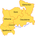 Hundreds of Middlesex.svg 735 × 756; 70 KB
 MCC Act Sewerage District for two works built 1931.png 1,443 × 1,503; 97 KB
 Middlesex - British Isles.svg 1,260 × 1,835; 943 KB
 Middlesex 1851 and 1911.png 1,566 × 1,570; 71 KB
 Middlesex Brit Isles Sect 5.svg 809 × 743; 939 KB
 Middlesex former postal county.svg 1,099 × 995; 752 KB
 Middlesex numbered 1961.PNG 1,546 × 1,570; 92 KB
 Middlesex parishes.jpg 1,449 × 1,259; 512 KB
 Middlesex poor law 1840.png 2,742 × 1,769; 173 KB
 Middlesex ĝis 1881.svg 1,108 × 1,345; 323 KB
 MiddlesexBrit5.PNG 625 × 569; 26 KB
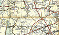 OS Heathrow 5th Edition.jpg 800 × 481; 263 KB
 Parish map 1838.jpg 814 × 636; 140 KB
 UB-postcode-area versus traditional terms.svg 589 × 587; 671 KB
.png)


