Category:Maps of Metz
Jump to navigation
Jump to search
Wikimedia category | |||||
| Upload media | |||||
| Instance of | |||||
|---|---|---|---|---|---|
| Category combines topics | |||||
| Metz | |||||
city in Grand Est, France      | |||||
| Pronunciation audio | |||||
| Instance of | |||||
| Location | |||||
| Located in or next to body of water | |||||
| Head of government |
| ||||
| Significant event |
| ||||
| Population |
| ||||
| Area |
| ||||
| Elevation above sea level |
| ||||
| Replaces | |||||
| Different from | |||||
| official website | |||||
 | |||||
Media in category "Maps of Metz"
The following 24 files are in this category, out of 24 total.
-
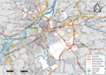
 57 MOSELLE carte grille communale densite INSEE.png 3,507 × 2,480; 3.44 MB
-
 57-AAV2020-Metz.png 3,519 × 3,197; 2.61 MB
-
 57-Metz-AAV2020.png 3,519 × 2,930; 3.19 MB
-
 57463-Metz-Routes-Hydro.png 3,507 × 2,480; 7.23 MB
-
 57463-Metz-Sols.png 3,270 × 2,598; 7.01 MB
-
 Arrondissement de Metz-Ville.PNG 850 × 680; 30 KB
-
 Carte Lorraine 15eme.png 954 × 888; 287 KB
-
 Corny-sur-Moselle - panoramio.jpg 2,592 × 1,944; 1.27 MB
-
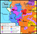
 Diocèse de Metz.svg 507 × 553; 148 KB
-
 Diocèse Metz 1789.svg 2,000 × 1,922; 801 KB
-
 Districts of Metz, France.jpg 300 × 300; 110 KB
-
 Le pays de Henri Grégoire (1750-1831).png 846 × 789; 1.03 MB
-
 Ligne Reding - Metz.svg 1,000 × 1,056; 54 KB
-
 Map commune FR insee code 57463.png 756 × 605; 116 KB
-
 Map Metz.jpg 1,961 × 2,033; 3.32 MB
-
 Metz dot.png 1,804 × 1,689; 164 KB
-
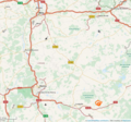
 Metz OSM 01.png 866 × 833; 543 KB
-
 Metz OSM 02.png 866 × 833; 932 KB
-
 Metz OSM 03.png 1,180 × 1,186; 2.44 MB
-
 Plan des quartiers de Metz.png 2,382 × 2,456; 375 KB
-
 Plan ferroviaire gare metz.svg 428 × 525; 16 KB
-
 Plan tcrm blida de metz.png 832 × 520; 51 KB
-
 Plan tcrm blida metz.png 800 × 500; 150 KB
-
 Railway map of France - Metz - animated - fr.gif 1,760 × 1,595; 10.38 MB


.png)


