Category:Maps of Lyon Tram
Jump to navigation
Jump to search
Media in category "Maps of Lyon Tram"
The following 18 files are in this category, out of 18 total.
-
 Nouveau plan de Lyon illustré, avec tramways en 1880.jpg 7,640 × 6,364; 8.88 MB
-
 Plan metro tram chemin.svg 3,723 × 2,767; 1.77 MB
-
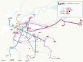
 Plan Réseau Tramway Lyon (2021).svg 3,320 × 2,250; 1.68 MB
-
 Plan Réseau Tramway Lyon (fin 2020).svg 3,320 × 2,250; 1.68 MB
-
 Plan tram Lyon.svg 3,320 × 2,250; 1.73 MB
-
 Situation Pont Raymond Barre.svg 657 × 504; 28 KB
-
 Tramway Lyon 1 Tracé.svg 1,280 × 1,350; 270 KB
-
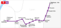
 Tramway Lyon 1-plan.svg 1,926 × 517; 408 KB
-
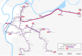
 Tramway Lyon 2 Tracé (2021).svg 2,230 × 1,415; 327 KB
-
 Tramway Lyon 2 Tracé.svg 2,230 × 1,415; 407 KB
-
 Tramway Lyon 3 Tracé (2020).svg 2,620 × 830; 207 KB
-
 Tramway Lyon 3 Tracé.svg 2,620 × 830; 256 KB
-
 Tramway Lyon 4 Tracé.svg 1,180 × 2,160; 355 KB
-
 Tramway Lyon 5 Tracé.svg 1,250 × 480; 143 KB
-
 Tramway Lyon 6 Tracé.svg 1,200 × 550; 168 KB
-
 Tramway Lyon 7 Tracé.svg 1,050 × 550; 66 KB
-
 Tramways de la ville de Lyon, réseau adopté vers 1880 1.jpg 5,054 × 4,298; 2.23 MB
-
 Tramways de la ville de Lyon. Réseau adopté vers 1880 2.jpg 5,204 × 4,192; 1.93 MB


.svg)
.svg)


.svg)


.svg)