Category:Maps of Landkreis Schwandorf
Jump to navigation
Jump to search
Deutsch: Karten und Pläne des Landkreises Schwandorf
Subcategories
This category has only the following subcategory.
Media in category "Maps of Landkreis Schwandorf"
The following 8 files are in this category, out of 8 total.
-
 221215 Geschäftsgebiet VR MiO eG.png 2,362 × 2,362; 1.26 MB
-
 Bahnstrecke Schwandorf–Furth im Wald.png 5,349 × 2,324; 5.74 MB
-
 Bavaria sad.png 237 × 245; 15 KB
-
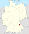
 Lage des Landkreises Schwandorf in Deutschland.png 176 × 234; 5 KB
-
 Landkreis Schwandorf in Bayern.svg 1,227 × 1,236; 275 KB
-
 Locator map SAD in Bavaria.svg 867 × 855; 1,010 KB
-
 Locator map SAD in Germany.svg 1,075 × 1,273; 581 KB
-
 SAD in Bayern.svg 1,227 × 1,236; 311 KB


