Category:Maps of Lake Geneva
Jump to navigation
Jump to search
Wikimedia category | |||||
| Upload media | |||||
| Instance of | |||||
|---|---|---|---|---|---|
| Category combines topics | |||||
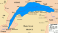
| Lake Geneva | |||||
lake in Switzerland and France      | |||||
| Pronunciation audio | |||||
| Instance of | |||||
| Named after | |||||
| Location |
| ||||
| Heritage designation | |||||
| Width |
| ||||
| Length |
| ||||
| Mountain range |
| ||||
| Area |
| ||||
| Elevation above sea level |
| ||||
| Inflows |
| ||||
| Outflows | |||||
| Drainage basin |
| ||||
| Basin country | |||||
| Different from | |||||
| Partially coincident with | |||||
 | |||||
Subcategories
This category has the following 17 subcategories, out of 17 total.
M
O
Media in category "Maps of Lake Geneva"
The following 40 files are in this category, out of 40 total.
-
 1261 Nyon.jpg 14,000 × 9,600; 82.02 MB
-
 260 St-Cergue.jpg 14,000 × 9,600; 20.96 MB
-
 261 Lausanne.jpg 14,000 × 9,600; 16.59 MB
-
 262 Rochers de Naye.jpg 14,000 × 9,600; 26.17 MB
-
 270 Genève.jpg 14,000 × 9,600; 22.78 MB
-
 271 Chablais.jpg 14,000 × 9,600; 24.15 MB
-
 74119-Évian-les-Bains-Géologie-Leg.pdf 1,754 × 1,239, 2 pages; 43 KB
-
 74119-Évian-les-Bains-Géologie.png 7,015 × 4,960; 3.91 MB
-
 74218-Publier-Géologie-Leg.pdf 1,754 × 1,239, 2 pages; 85 KB
-
 74218-Publier-Géologie.png 7,015 × 4,960; 4.24 MB
-
 74281-Thonon-les-Bains-Géologie.png 7,015 × 4,960; 6.09 MB
-
 Bise noire.svg 1,280 × 795; 176 KB
-
 Bise.svg 1,280 × 795; 176 KB
-
 Carte du Léman (avec ses subdivisions).png 1,800 × 1,021; 251 KB
-
 Carte du Léman subdivisions-Grand Lac.png 1,626 × 926; 179 KB
-
 Carte du Léman subdivisions-Haut Lac.png 1,626 × 926; 176 KB
-
 Carte du Léman subdivisions-Petit Lac.png 1,626 × 926; 177 KB
-
 Carte du Léman subdivisions.png 1,626 × 926; 175 KB
-
 Carte du Léman.png 864 × 490; 21 KB
-
 CH-NB Photoglob-Wehrli EAD-WEHR-14112-B.tif 7,494 × 5,684, 2 pages; 81.31 MB
-
 ETH-BIB-Strasse von Gibraltar und Lac de Genève 1- 8000'000-Dia 247-Z-00197.tif 3,620 × 2,896; 30.11 MB
-
 Genfersee BLANCO.png 1,771 × 1,059; 241 KB
-
 Genfersee DE.png 1,771 × 1,059; 367 KB
-
 Genfersee ES.png 1,181 × 660; 272 KB
-
 Genfersee FR.png 1,181 × 660; 275 KB
-
 Genfersee HE.png 1,771 × 1,059; 339 KB
-
 Genfersee satellit Bol d Or.jpg 1,280 × 795; 138 KB
-
 Joran.svg 1,280 × 795; 173 KB
-
 Kaart meer van geneve.jpg 331 × 168; 10 KB
-
 Karte Genfersee.png 1,181 × 620; 210 KB
-
 Lago Leman.png 474 × 312; 15 KB
-
 Léman BassinVersant.png 3,637 × 1,842; 1.32 MB
-
 Léman Bathymétrie.png 3,511 × 2,239; 4.61 MB
-
 Léman CarteTectonique.png 1,331 × 1,331; 304 KB
-
 Léman CarteTectonique.svg 1,525 × 1,525; 140 KB
-
 Parcours 5jours du leman.png 2,385 × 1,593; 55 KB
-
 Plan piste.jpg 640 × 440; 231 KB
-
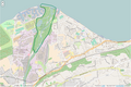 Périmètre RNN Delta de la Dranse rnn43.png 1,239 × 828; 725 KB
-
 Périmètre RNN Haute-chaîne du Jura rnn112.png 1,038 × 1,483; 1.74 MB
-
 Swiss national map, 40 Le Léman.jpg 14,000 × 9,600; 111.37 MB


.png)


