Category:Maps of Helsingborg
Jump to navigation
Jump to search
Wikimedia category | |||||
| Upload media | |||||
| Instance of | |||||
|---|---|---|---|---|---|
| Category combines topics | |||||
| Helsingborg | |||||
town and the seat of Helsingborg Municipality in southern Sweden  Inre hamnen | |||||
| Pronunciation audio | |||||
| Instance of | |||||
| Location |
| ||||
| Inception |
| ||||
| Significant event |
| ||||
| Population |
| ||||
| Area |
| ||||
| Different from | |||||
| official website | |||||
 | |||||
Subcategories
This category has only the following subcategory.
O
Pages in category "Maps of Helsingborg"
This category contains only the following page.
Media in category "Maps of Helsingborg"
The following 82 files are in this category, out of 82 total.
-
 2017-06-09 Reiseroute-Karte Helsingborg.jpg 1,287 × 844; 594 KB
-
 Approximate route of Helsingborg–Råå–Ramlösa Järnväg (superimposed onto OpenStreetMap).jpg 3,780 × 2,993; 2.03 MB
-
 HBG C karta.jpg 1,397 × 1,500; 1.17 MB
-
 Helsingborg Adolfsberg locator map.svg 263 × 317; 828 KB
-
 Helsingborg Berga locator map.svg 263 × 317; 828 KB
-
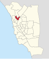
 Helsingborg Centrum locator map.svg 263 × 317; 828 KB
-
 Helsingborg Dalhem locator map.svg 263 × 317; 828 KB
-
 Helsingborg Drottninghög locator map.svg 263 × 317; 828 KB
-
 Helsingborg Elineberg locator map.svg 263 × 317; 828 KB
-
 Helsingborg Eneborg locator map.svg 263 × 317; 828 KB
-
 Helsingborg Eskilsminne locator map.svg 263 × 317; 828 KB
-
 Helsingborg Fredriksdal locator map.svg 263 × 317; 828 KB
-
 Helsingborg Fältabacken locator map.svg 263 × 317; 828 KB
-
 Helsingborg Gustavslund locator map.svg 263 × 317; 828 KB
-
 Helsingborg Husensjö locator map.svg 263 × 317; 828 KB
-
 Helsingborg Högaborg locator map.svg 263 × 317; 828 KB
-
 Helsingborg Högasten locator map.svg 263 × 317; 828 KB
-
 Helsingborg in Sweden.png 328 × 714; 18 KB
-
 Helsingborg Mariastaden locator map.svg 263 × 317; 828 KB
-
 Helsingborg Miatorp locator map.svg 263 × 317; 828 KB
-
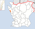
 Helsingborg Municipality in Scania County.png 607 × 507; 45 KB
-
 Helsingborg Municipality in Scania.png 320 × 311; 6 KB
-
 Helsingborg Norr locator map.svg 263 × 317; 828 KB
-
 Helsingborg Närlunda locator map.svg 263 × 317; 828 KB
-
 Helsingborg Oceanhamnen locator map.svg 263 × 317; 828 KB
-
 Helsingborg Olympia locator map.svg 263 × 317; 828 KB
-
 Helsingborg Planteringen locator map.svg 263 × 317; 828 KB
-
 Helsingborg Ramlösa locator map.svg 263 × 317; 828 KB
-
 Helsingborg Ringstorp locator map.svg 263 × 317; 828 KB
-
 Helsingborg Rosengården locator map.svg 263 × 317; 828 KB
-
 Helsingborg Råå locator map.svg 263 × 317; 828 KB
-
 Helsingborg Slottshöjden locator map.svg 263 × 317; 828 KB
-
 Helsingborg Sofieberg locator map.svg 263 × 317; 828 KB
-
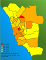
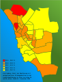
 Helsingborg stadsdelar arbetslöshet2005 se.svg 1,727 × 2,277; 209 KB
-
 Helsingborg stadsdelar invandrare2005 se.svg 1,727 × 2,277; 211 KB
-
 Helsingborg stadsdelar utbildningsnivå2005 se.svg 1,727 × 2,277; 210 KB
-
 Helsingborg stadsdelar årsinkomst2004 se.svg 1,727 × 2,277; 210 KB
-
 Helsingborg stadtteil adolfsberg.svg 1,727 × 2,277; 159 KB
-
 Helsingborg stadtteil attekulla.svg 1,727 × 2,277; 159 KB
-
 Helsingborg stadtteil berga.svg 1,727 × 2,277; 159 KB
-
 Helsingborg stadtteil centrum.svg 1,727 × 2,277; 159 KB
-
 Helsingborg stadtteil dalhem.svg 1,727 × 2,277; 159 KB
-
 Helsingborg stadtteil drottninghog.svg 1,727 × 2,277; 159 KB
-
 Helsingborg stadtteil elineberg.svg 1,727 × 2,277; 159 KB
-
 Helsingborg stadtteil eneborg.svg 1,727 × 2,277; 159 KB
-
 Helsingborg stadtteil eskilsminne.svg 1,727 × 2,277; 159 KB
-
 Helsingborg stadtteil faltabacken.svg 1,727 × 2,277; 159 KB
-
 Helsingborg stadtteil fredriksdal.svg 1,727 × 2,277; 159 KB
-
 Helsingborg stadtteil gustavslund.svg 1,727 × 2,277; 159 KB
-
 Helsingborg stadtteil hogaborg.svg 1,727 × 2,277; 159 KB
-
 Helsingborg stadtteil hogasten.svg 1,727 × 2,277; 159 KB
-
 Helsingborg stadtteil husensjo.svg 1,727 × 2,277; 161 KB
-
 Helsingborg stadtteil mariastaden.svg 1,727 × 2,277; 161 KB
-
 Helsingborg stadtteil miatorp.svg 1,727 × 2,277; 159 KB
-
 Helsingborg stadtteil narlunda.svg 1,727 × 2,277; 159 KB
-
 Helsingborg stadtteil norr.svg 1,727 × 2,277; 161 KB
-
 Helsingborg stadtteil olympia.svg 1,727 × 2,277; 159 KB
-
 Helsingborg stadtteil planteringen.svg 1,727 × 2,277; 159 KB
-
 Helsingborg stadtteil raa.svg 1,727 × 2,277; 159 KB
-
 Helsingborg stadtteil ramlosa.svg 1,727 × 2,277; 159 KB
-
 Helsingborg stadtteil ringstorp.svg 1,727 × 2,277; 159 KB
-
 Helsingborg stadtteil rosengarden.svg 1,727 × 2,277; 159 KB
-
 Helsingborg stadtteil slottshojden.svg 1,727 × 2,277; 159 KB
-
 Helsingborg stadtteil soder.svg 1,727 × 2,277; 159 KB
-
 Helsingborg stadtteil sofieberg.svg 1,727 × 2,277; 159 KB
-
 Helsingborg stadtteil stattena.svg 1,727 × 2,277; 159 KB
-
 Helsingborg stadtteil tagaborg.svg 1,727 × 2,277; 159 KB
-
 Helsingborg stadtteil wilson park.svg 1,727 × 2,277; 159 KB
-
 Helsingborg stadtteile arbeitslosenquote2005 de.svg 1,727 × 2,277; 158 KB
-
 Helsingborg stadtteile auslaenderanteil2005 de.svg 1,727 × 2,277; 159 KB
-
 Helsingborg stadtteile bildungsniveau2005 de.svg 1,727 × 2,277; 158 KB
-
 Helsingborg stadtteile jahreseinkommen2004 de.svg 1,727 × 2,277; 158 KB
-
 Helsingborg stadtteile ueberblick.svg 1,727 × 2,277; 184 KB
-
 Helsingborg Stattena locator map.svg 263 × 317; 828 KB
-
 Helsingborg Söder locator map.svg 263 × 317; 828 KB
-
 Helsingborg town in Scania County.png 607 × 507; 62 KB
-
 Helsingborg Tågaborg locator map.svg 263 × 317; 828 KB
-
 Helsingborg Wilson Park locator map.svg 263 × 317; 828 KB
-
 Helsingborg Ättekulla locator map.svg 263 × 317; 828 KB
-
 Helsingborg Östra Ramlösa locator map.svg 263 × 317; 828 KB
-
 Helsingborg-Ramlösa (stationsmarkering).jpg 898 × 497; 468 KB
-
 Helsingborg-Ramlösa.jpg 898 × 497; 450 KB

.jpg)


.jpg)
