Category:Maps of Harpers Ferry, West Virginia
Jump to navigation
Jump to search
Subcategories
This category has only the following subcategory.
Media in category "Maps of Harpers Ferry, West Virginia"
The following 9 files are in this category, out of 9 total.
-
 Harper's Ferry (1863) LOC 99448910.jpg 8,609 × 7,150; 13.64 MB
-
 Harpers Ferry 1863.jpg 8,830 × 7,558; 17.06 MB
-
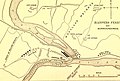 Harpers Ferry and surroundings.jpg 819 × 550; 170 KB
-
 Map of Harpers Ferry, Virginia in 1859.jpg 1,069 × 1,623; 965 KB
-
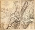
 Map of Harpers Ferry.jpg 841 × 858; 206 KB
-
 Military maps of the war of the Rebellion-miscellaneous, (1865-1879). LOC 2009581114-24.tif 9,110 × 7,710; 200.95 MB
-
 Sketch of the vicinity of Harpers Ferry, (W.) Va., by Wm. Luce, Oct. 1862 - NARA - 305575.tif 5,200 × 4,414; 65.67 MB
-
 Vicinity of Winchester and Harper's Ferry, Va. LOC gvhs01.vhs00271.jpg 2,736 × 2,232; 921 KB
-

_LOC_99448910.jpg)


.jpg)