Category:Maps of Gloucestershire
Jump to navigation
Jump to search
Wikimedia category | |||||
| Upload media | |||||
| Instance of | |||||
|---|---|---|---|---|---|
| Category combines topics | |||||
| Gloucestershire | |||||
ceremonial county in England (use Q21694733 for administrative non-metropolitan county) .jpg)   | |||||
| Instance of |
| ||||
| Location |
| ||||
| Capital | |||||
| Population |
| ||||
| Area |
| ||||
| Different from | |||||
| Said to be the same as | Gloucestershire (historic county of England, ceremonial county of England, 1844) | ||||
| official website | |||||
 | |||||
Subcategories
This category has the following 9 subcategories, out of 9 total.
Media in category "Maps of Gloucestershire"
The following 41 files are in this category, out of 41 total.
-
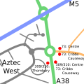 Aztec West Transport.svg 500 × 500; 20 KB
-
 Bourton on the water map 7909.jpg 2,400 × 1,643; 4.15 MB
-
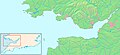
 Bristol channel detailed map.png 600 × 276; 47 KB
-
 Bristol-channel-clean-HE.jpg 600 × 276; 167 KB
-
 Bristol-channel-clean.jpg 600 × 276; 139 KB
-
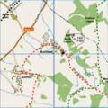 Buckland, Gloucestershire Map.png 1,002 × 1,003; 207 KB
-
 Cheltenhamceremonial.PNG 200 × 214; 6 KB
-
 Cotswolds AONB locator map.svg 1,648 × 2,000; 1.08 MB
-
 England Police Forces (Gloucestershire).svg 1,108 × 1,345; 312 KB
-
 EnglandGloucestershireTrad.png 200 × 250; 27 KB
-
 EnglandPoliceGloucestershire.png 2,165 × 2,670; 87 KB
-
 Essex relief of Gloucester 1643.jpg 1,038 × 732; 177 KB
-
 GlossT.PNG 200 × 170; 4 KB
-
 Gloucestershire - British Isles.svg 1,260 × 1,835; 943 KB
-
 Gloucestershire 1832 Map.png 1,999 × 2,075; 731 KB
-
 Gloucestershire Brit Isles Sect 5.svg 809 × 743; 939 KB
-
 Gloucestershire Brit Isles Sect 6.svg 545 × 593; 938 KB
-
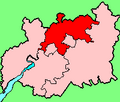
 Gloucestershire Ceremonial Numbered.png 200 × 214; 5 KB
-
 Gloucestershire numbered districts.svg 1,089 × 1,266; 738 KB
-
 Gloucestershire outline map with UK.png 600 × 714; 398 KB
-
 Gloucestershire UK constituency map (blank).svg 1,089 × 1,266; 1.16 MB
-
 Gloucestershire UK district map (blank).svg 1,089 × 1,266; 1.09 MB
-
 Gloucestershire UK electoral division map (blank).svg 1,089 × 1,266; 1.62 MB
-
 Gloucestershire UK electoral division map 2013 (blank).svg 1,089 × 1,266; 1.33 MB
-
 Gloucestershire UK location map.svg 1,089 × 1,266; 2.27 MB
-
 Gloucestershire UK locator map 2010.svg 1,108 × 1,345; 302 KB
-
 Gloucestershire UK parish map (blank).svg 1,089 × 1,266; 2.84 MB
-
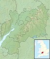 Gloucestershire UK relief location map.jpg 2,010 × 2,339; 536 KB
-
 Gloucestershire UK ward map (blank).svg 1,089 × 1,266; 2.26 MB
-
 GloucestershireBrit5.PNG 625 × 569; 26 KB
-
 Great Britain 20th Century Map - Long Newnton.png 424 × 273; 297 KB
-
 Gloucestershire Hundreds.svg 1,000 × 978; 728 KB
-
 Map of Acton Turville Parish.PNG 526 × 393; 417 KB
-
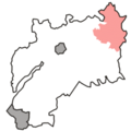 Ncotswold.png 351 × 350; 15 KB
-
 Ordnance Survey 1-250000 - SO.jpg 4,000 × 4,000; 9.7 MB
-
 Ordnance Survey 1-250000 - SP.jpg 4,000 × 4,000; 9.22 MB
-
 Ordnance Survey 1-250000 - ST.jpg 4,000 × 4,000; 8.92 MB
-
 Ordnance Survey 1-250000 - SU.jpg 4,000 × 4,000; 9.11 MB
-
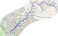 River Frome.jpg 1,086 × 674; 359 KB
-
 Upper and Lower Lea.svg 2,590 × 3,116; 12 KB
-
 West of England Combined Authority UK map.svg 1,425 × 1,241; 1,003 KB


.svg)


.svg)
.svg)
.svg)
.svg)
.svg)
.svg)