Category:Maps of Glacier Bay National Park
Jump to navigation
Jump to search
United States national parks: Acadia · American Samoa · Arches · Badlands · Big Bend · Biscayne · Black Canyon of the Gunnison · Bryce Canyon · Canyonlands · Capitol Reef · Carlsbad Caverns · Channel Islands · Congaree · Crater Lake · Cuyahoga Valley · Death Valley · Denali · Dry Tortugas · Everglades · Gateway Arch · Gates of the Arctic · Glacier · Glacier Bay · Grand Canyon · Grand Teton · Great Basin · Great Smoky Mountains · Guadalupe Mountains · Haleakalā · Hawaii Volcanoes · Hot Springs · Indiana Dunes · Isle Royale · Joshua Tree · Kenai Fjords · Kings Canyon · Kobuk Valley · Lake Clark · Lassen Volcanic · Mammoth Cave · Mesa Verde · Mount Rainier · North Cascades · Olympic · Petrified Forest · Pinnacles · Redwood · Rocky Mountain · Saguaro · Sequoia · Shenandoah · Theodore Roosevelt · Virgin Islands · Voyageurs · White Sands · Wind Cave · Wrangell-St. Elias · Yellowstone · Yosemite · Zion
English: Maps of Glacier Bay National Park and Preserve
Wikimedia category | |||||
| Upload media | |||||
| Instance of | |||||
|---|---|---|---|---|---|
| Category combines topics | |||||
| Glacier Bay National Park and Preserve | |||||
national park of the United States  Glacier Bay | |||||
| Instance of | |||||
| Part of | |||||
| Location | Hoonah–Angoon Census Area, Unorganized Borough, Alaska | ||||
| Operator | |||||
| Heritage designation |
| ||||
| IUCN protected areas category | |||||
| Inception |
| ||||
| Highest point | |||||
| Area |
| ||||
| Visitors per year |
| ||||
| official website | |||||
 | |||||
Subcategories
This category has the following 4 subcategories, out of 4 total.
M
- Maps of Johns Hopkins Inlet (1 F)
Media in category "Maps of Glacier Bay National Park"
The following 18 files are in this category, out of 18 total.
-
 Glacier Bay Glacial Extent.png 371 × 576; 64 KB
-
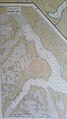
 Glacier Bay National Park NPS map of glacial ice extent in 1879.jpg 2,988 × 5,312; 1.89 MB
-
 Glacier Bay National Park official park brochure map.jpg 2,020 × 1,222; 1.51 MB
-
 Glacier National Park NPS map of glacial ice extent in 1980.jpg 2,988 × 5,312; 2.07 MB
-
 Glacier-bay-map.jpg 772 × 954; 64 KB
-
 Glacierbaymap.gif 420 × 458; 29 KB
-
 LocMap Glacier Bay National Park.png 280 × 183; 31 KB
-
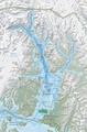
 Map of Glacier Bay National Park.png 3,214 × 2,910; 6.08 MB
-
 NOAA map of Glacier Bay National Park.jpg 2,988 × 5,312; 3.35 MB
-
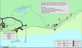 NPS glacier-bay-bartlett-cove-campground-map.jpg 2,484 × 1,445; 326 KB
-
 NPS glacier-bay-detail-map.jpg 1,672 × 2,534; 876 KB
-
 NPS glacier-bay-detail-map.pdf 1,791 × 2,714; 3.88 MB
-
 NPS glacier-bay-map.jpg 2,642 × 2,214; 1.07 MB
-
 NPS glacier-bay-map.pdf 2,202 × 1,843; 4.01 MB
-
 NPS glacier-bay-regional-map.jpg 502 × 963; 64 KB
-
 NPS glacier-bay-regional-map.pdf 375 × 720; 86 KB
-
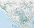
 NPS glacier-bay-vegetation-map.jpg 6,038 × 3,942; 3.8 MB
-
 NPS glacier-bay-water-terminus-map.jpg 2,094 × 1,603; 798 KB


