Category:Maps of Fordham, Bronx
Jump to navigation
Jump to search
Media in category "Maps of Fordham, Bronx"
The following 23 files are in this category, out of 23 total.
-

-
 Bromley Bronx Plate 23 publ. 1938 corr. 1957.jpg 9,263 × 6,620; 16.54 MB
-
 Bromley Bronx Plate 23 publ. 1938.jpg 8,798 × 6,226; 14.98 MB
-
 Bromley Bronx volume index publ. 1938.jpg 8,615 × 5,920; 14.02 MB
-
 Bronx topographical Sheet 06 publ. 1873.jpg 5,616 × 4,926; 6.52 MB
-
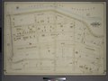
 Bronx, V. 13, Plate No. 26 (Map bounded by Kingsbridge Rd., Aqueduct Ave., E. 188thSt., Harlem River) NYPL2002812.tiff 6,720 × 8,968, 2 pages; 172.48 MB
-

-

-

-

-

-

-

-
-
 Fordham.png 156 × 179; 14 KB
-
 Robinson Manhattan and Bronx Plate 38 publ. 1885.jpg 6,051 × 4,053; 8.35 MB
-
 Robinson Manhattan and Bronx Plate 39 publ. 1885.jpg 6,033 × 4,039; 35.52 MB
-
 Robinson Manhattan and Bronx Plate 40 publ. 1885.jpg 6,033 × 4,052; 35.36 MB
-
 Sanborn V. 13 Plate 26 publ. 1900.jpg 6,720 × 8,968; 45.52 MB
-

-

-
-

_-_Bronx_County_-_Bronx_County_-_ED_3-1_to_2101_-_NARA_-_24066691_(page_3).jpg)


