Category:Maps of Cardiff
Jump to navigation
Jump to search
Wikimedia category | |||||
| Upload media | |||||
| Instance of | |||||
|---|---|---|---|---|---|
| Category combines topics | |||||
| Cardiff | |||||
capital city of Wales, United Kingdom   .jpg)       | |||||
| Pronunciation audio | |||||
| Instance of |
| ||||
| Named after | |||||
| Location | Cardiff, Wales | ||||
| Located in or next to body of water | |||||
| Official language | |||||
| Inception |
| ||||
| Significant event |
| ||||
| Population |
| ||||
| Area |
| ||||
| Elevation above sea level |
| ||||
| Different from | |||||
| official website | |||||
 | |||||
Subcategories
This category has the following 5 subcategories, out of 5 total.
Media in category "Maps of Cardiff"
The following 46 files are in this category, out of 46 total.
-
 2017 Plasdwr in Cardiff location map.png 720 × 768; 202 KB
-
 2024 Wales Cardiff Community map.svg 512 × 546; 319 KB
-
 Bristol channel detailed map.png 600 × 276; 47 KB
-
 Bristol-channel-clean-HE.jpg 600 × 276; 167 KB
-
 Bristol-channel-clean.jpg 600 × 276; 139 KB
-
 Cardiff in Wales.svg 1,047 × 1,252; 395 KB
-
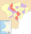
 Cardiff UK community councils.svg 1,187 × 1,266; 438 KB
-
 Cardiff UK community map (blank).svg 1,187 × 1,266; 437 KB
-
 Cardiff UK location map.svg 1,187 × 1,266; 464 KB
-
 Cardiff UK map.svg 1,187 × 1,266; 299 KB
-
 Cardiff UK relief location map.jpg 2,010 × 2,146; 254 KB
-
 Cardiff UK ward map (blank).svg 1,187 × 1,266; 434 KB
-
 Cardiff UK ward map 2017 (blank).svg 1,187 × 1,266; 651 KB
-
 Cardiff UK ward map 2022 (blank).svg 79 × 87; 676 KB
-
 Cardiff UK ward map 2022 - number of councillors.png 800 × 875; 142 KB
-
 Cardiffmap1946.jpg 2,000 × 1,568; 3.09 MB
-
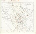 Cardiffroad map 1948.jpg 2,550 × 2,415; 585 KB
-
 Castell coch woodlands sssi map.svg 374 × 330; 193 KB
-
 Cathays memorial map with proposed site for National Museum and Library.jpg 2,000 × 1,304; 2.43 MB
-
 CCR or Greater Cardiff.png 938 × 720; 129 KB
-
 Cew canton.jpg 280 × 192; 13 KB
-
 Cew gabalfa.jpg 280 × 192; 13 KB
-
 Cew heath.jpg 280 × 192; 13 KB
-
 Cew llandaff north.jpg 280 × 192; 13 KB
-
 Cew llandaff.jpg 280 × 192; 13 KB
-
 Falk Oberdorf Karte Park Cardiff.png 842 × 330; 109 KB
-
 Flat Holm Battery sites.jpg 596 × 464; 31 KB
-
 Image taken from page 110 of 'The Port of Cardiff. (With map.)' (11157617014).jpg 2,348 × 1,877; 888 KB
-
 John Speed - Map of Landaffe.png 1,091 × 833; 1.96 MB
-
 John Speed's map of Landaffe.png 1,091 × 814; 1.79 MB
-
 Llandaff.1610.Speed.map.jpg 1,800 × 1,243; 223 KB
-
 Location map Cardiff.png 256 × 256; 34 KB
-
 Location map Wales Cardiff Central.png 721 × 665; 350 KB
-
 Location map Wales Cardiff.png 697 × 564; 406 KB
-
 Millennium Stadium Cardiff map copy (cropped).jpg 226 × 277; 52 KB
-
 Millennium Stadium Cardiff map copy.jpg 383 × 470; 82 KB
-
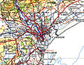
 Ordnance Survey 1-250000 - ST.jpg 4,000 × 4,000; 8.92 MB
-
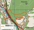
 Radyr Woods Information Sign.JPG 2,304 × 3,072; 3.29 MB
-
 South Wales 2.png 400 × 497; 57 KB
-
 Urban Tap House, Cardiff - map.jpg 1,064 × 800; 801 KB
-
 Wales Cardiff Capital Region locator map.svg 512 × 612; 148 KB
-
 Wales Cardiff locator map.svg 1,047 × 1,251; 146 KB
-
 Wales Cardiff.png 335 × 431; 7 KB
-
 Wales Cardiff.svg 512 × 612; 277 KB
-
 WalesCardiff.png 200 × 225; 13 KB
-
 West Grove, Cardiff.png 498 × 653; 408 KB


%27_(11157617014).jpg)


.jpg)


.svg)
.svg)
.svg)
.svg)