Category:Maps of Cantabria
Jump to navigation
Jump to search
Autonomous communities of Spain: Andalusia · Aragon · Asturias · Balearic Islands · Basque Autonomous Community · Canary Islands · Cantabria · Castile and León · Castile-La Mancha · Catalonia · Extremadura · Galicia · Community of Madrid · Region of Murcia · Navarre · La Rioja · Valencian Community · Autonomous cities: Ceuta · Melilla
Wikimedia category | |||||
| Upload media | |||||
| Instance of | |||||
|---|---|---|---|---|---|
| Category combines topics | |||||
| Cantabria | |||||
autonomous community of Spain  .svg) .svg)  | |||||
| Instance of | |||||
| Location | Spain | ||||
| Located in or next to body of water | |||||
| Capital | |||||
| Anthem |
| ||||
| Head of government |
| ||||
| Occupant | |||||
| Has part(s) |
| ||||
| Inception |
| ||||
| Highest point |
| ||||
| Population |
| ||||
| Area |
| ||||
| Follows | |||||
| official website | |||||
 | |||||

Subcategories
This category has the following 18 subcategories, out of 18 total.
*
- Location maps of Cantabria (5 F)
- MTN25 printed of Cantabria (172 F)
B
- Blank maps of Cantabria (1 F)
C
D
- Demographic maps of Cantabria (20 F)
E
F
- Flag maps of Cantabria (3 F)
H
- Maps of the history of Cantabria (11 F)
J
M
- Maps of Santoña (6 F)
O
- Old maps of Cantabria (8 F)
P
- Maps of the Picos de Europa (6 F)
T
- Topographic maps of Cantabria (12 F)
Media in category "Maps of Cantabria"
The following 26 files are in this category, out of 26 total.
-
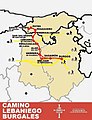 Camino Lebaniego Burgalés.jpg 737 × 958; 161 KB
-
 Cantabria Crecimiento 2008-2018.png 1,000 × 647; 100 KB
-
 Cantabria Crecimiento-1998-2008.png 1,000 × 647; 100 KB
-
 Cantabria Densidad 2018.png 1,000 × 647; 94 KB
-
 Cantabria Poblacion 2018.png 1,000 × 647; 94 KB
-
 Distribución espacial de la temperatura media anual en Cantabria.png 960 × 720; 1,003 KB
-
 Diócesis de Santander.png 266 × 189; 3 KB
-
 Fonetica montanesa.png 275 × 152; 8 KB
-
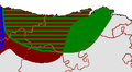
 Franco-Cantabrian region Altamira.gif 956 × 482; 21 KB
-
 Franco-Cantabrian region.gif 956 × 482; 21 KB
-
 Mancom reducida.jpg 411 × 640; 134 KB
-
 MancomunidadAltamiraLosValles.jpg 1,063 × 1,654; 677 KB
-
 Map camargo.svg 1,545 × 1,279; 21 KB
-
 Mapa autonomico de Cantabria MA200.jpg 10,039 × 7,377; 40.74 MB
-
 Mapa de Camargo.png 1,022 × 765; 119 KB
-
 Mapa del Churi en Camargo.png 480 × 322; 44 KB
-
 Mapa dialectal de Cantabria.png 778 × 413; 57 KB
-
 Mapaotero2.gif 530 × 360; 94 KB
-
 Municiopios en Comarcas van cantabria.png 675 × 593; 96 KB
-
 Municipios Cantabria2.jpg 963 × 587; 126 KB
-
 Parques Naturales y Nacionales de Cantabria.png 1,167 × 734; 583 KB
-
 PCant.PNG 522 × 336; 35 KB
-
 Plano Camino de Santiago Vía Aquitania.jpg 452 × 293; 65 KB
-
 Plano camino principal.jpg 721 × 960; 144 KB
-
 Pluvio-anua1981-2010.png 960 × 720; 996 KB
-
 Rutas por anievas.jpg 576 × 438; 38 KB


