Category:Maps of Bulgaria during World War II
Jump to navigation
Jump to search
Countries of Europe: Albania · Belarus · Belgium · Bosnia and Herzegovina · Bulgaria · France‡ · Germany · Hungary · Latvia · Lithuania · Luxembourg · Montenegro · Netherlands‡ · Poland · Serbia
Media in category "Maps of Bulgaria during World War II"
The following 56 files are in this category, out of 56 total.
-
 AtlBalk1942.jpg 318 × 327; 141 KB
-
 Bulgaria during WWII - map explanation.png 1,356 × 196; 90 KB
-
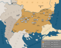
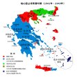
 Map of Bulgaria during WWII-BG.png 1,298 × 862; 255 KB
-
 Map of Bulgaria during WWII-es.svg 1,222 × 810; 813 KB
-
 Map of Bulgaria during WWII-IT.png 4,072 × 2,701; 1.21 MB
-
 Map of Bulgaria during WWII-j.png 800 × 479; 27 KB
-
 Map of Bulgaria during WWII-RU.png 1,305 × 860; 258 KB
-
 Map of Bulgaria during WWII.png 1,301 × 855; 253 KB
-
 제2차 세계 대전 기간의 불가리아 지도 설명.png 1,356 × 196; 30 KB
-
 제2차 세계 대전 기간의 불가리아.png 1,301 × 855; 192 KB
-
 Administrative map of Bulgaria during WWII de.svg 715 × 461; 165 KB
-
 Administrative map of Bulgaria during WWII sr.svg 715 × 461; 165 KB
-
 Administrative map of Bulgaria during WWII-mk.svg 715 × 461; 213 KB
-
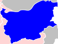
 Administrative map of Bulgaria during WWII.svg 715 × 461; 165 KB
-
 Map of Bulgaria WWII.gif 715 × 461; 20 KB
-
 KingdomOfBulgaria1941-1944.png 2,500 × 1,770; 1,003 KB
-
 Bg IIWW MAP.jpg 800 × 538; 189 KB
-
 Bulgarian lends in WWII.jpg 3,021 × 2,232; 2.23 MB
-
 Bulgarien Air Forces August 1944.png 1,593 × 1,263; 511 KB
-
 Bulgária 1942.gif 466 × 382; 4 KB
-
 Gebietsveränderungen Balkan 1938-43.png 387 × 617; 298 KB
-
 Gr-triple-occupation-ES.png 899 × 917; 81 KB
-
 Gr-triple-occupation-Česky.JPG 884 × 876; 83 KB
-
 Gr-triple-occupation.png 899 × 917; 82 KB
-
 Greece occupation1.png 811 × 847; 68 KB
-
 Kingdom of Bulgaria (1942).svg 450 × 456; 500 KB
-
 Kingdom of Bulgaria (1944).svg 55 × 42; 658 KB
-
 Kosovo 1941-sr.png 663 × 772; 48 KB
-
 Kosovo 1941.png 663 × 772; 54 KB
-
 Localitatile din Timocul bulgaresc locuite de romani, 1941.jpg 2,293 × 1,683; 1.05 MB
-
 Map of Bulgaria during WWII-mk.svg 1,222 × 810; 720 KB
-
 Map of Greece during WWII-IT.png 2,693 × 2,083; 848 KB
-
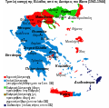
 Map of Greece during WWII.png 1,717 × 1,334; 480 KB
-
 Map of Kosovo during WW II.png 783 × 524; 97 KB
-
 Map of Vardar Macedonia during WW II.png 814 × 666; 135 KB
-
 Occupation de la grece (1941-1944) -fr.png 851 × 869; 113 KB
-
 Occupation-de-la-grece-he.png 899 × 917; 86 KB
-
 OcupaciónDeGreciaPorElEje.svg 800 × 917; 548 KB
-
 PL-triple-occupation.png 899 × 917; 100 KB
-
 Responsability zones Mac WW II.jpg 517 × 395; 58 KB
-
 Soviet invasion Bulgaria 1944.png 1,658 × 1,050; 4.12 MB
-
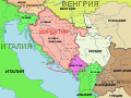
 Spartizione territoriale della Jugoslavia nel 1941.png 1,047 × 894; 122 KB
-
 Triple occupation of Greece de.svg 812 × 763; 109 KB
-
 Triple occupation of Greece el.svg 1,158 × 1,147; 91 KB
-
 Triple occupation of Greece es.svg 1,158 × 1,147; 78 KB
-
 Triple occupation of Greece mk.svg 812 × 763; 359 KB
-
 Triple occupation of Greece-zh.svg 812 × 763; 113 KB
-
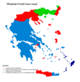
 Triple Occupation of Greece.png 899 × 917; 186 KB
-
 Triple occupation of Greece2 es.svg 1,158 × 1,147; 191 KB
-
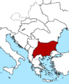
 Western Balkans 1942-2008-hu.svg 1,222 × 930; 248 KB
-
 Western Balkans 1942.2008 (ru).png 900 × 675; 338 KB
-
 Western Balkans 1942.2008 (ru).svg 1,200 × 900; 298 KB
-
 Western Balkans 1942.2008 ca.svg 1,222 × 930; 246 KB
-
 Western Balkans 1942.2008 ES.svg 1,222 × 930; 543 KB
-
 Western Balkans 1942.2008.png 800 × 600; 292 KB
-
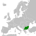
 WorldWarIILocationMapBU.png 630 × 766; 23 KB


.svg)
.svg)


_-fr.png)


.png)
.svg)


