Category:Maps of Brest (France) during World War II
Jump to navigation
Jump to search
Media in category "Maps of Brest (France) during World War II"
The following 8 files are in this category, out of 8 total.
-
 7FI 00091 Plan of port and town 1943.jpg 3,730 × 2,514; 4.14 MB
-
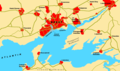
 Approachtobrest.png 939 × 598; 53 KB
-
 Brest-Attacke 01.png 1,280 × 760; 265 KB
-
 Brest-Attacke 02.png 947 × 759; 356 KB
-
 Brest.png 1,280 × 760; 165 KB
-
 Defenses of Brest 74003542 001 001.jpg 8,480 × 6,591; 3.88 MB
-
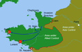
 US advance to Brest.png 742 × 516; 473 KB
-
 US Army official history map of the Battle for Brest.jpg 1,024 × 920; 355 KB


