Category:Maps of Berlin-Wilhelmsruh
Jump to navigation
Jump to search
Media in category "Maps of Berlin-Wilhelmsruh"
The following 7 files are in this category, out of 7 total.
-
 Berlin Pankow Wilhelmsruh.png 619 × 842; 68 KB
-
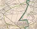 Berlin-Wilhelmsruh im Bezirk Reinickendorf 1920 bis 1938.jpg 953 × 749; 318 KB
-
 Berlin-Wilhelmsruh Karte.png 541 × 432; 197 KB
-
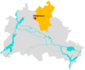 Lage Wilhelmsruh.png 1,966 × 1,623; 179 KB
-
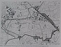
 Wilhelmsruh 1892.jpg 551 × 444; 69 KB
-
 Wilhelmsruh Gebietsaustausch 1938.jpg 648 × 498; 73 KB
-
 Wilhelmsruh-Silva1925.jpg 1,596 × 895; 807 KB


