Category:Maps of Belle-Île-en-Mer
Jump to navigation
Jump to search
Wikimedia category | |||||
| Upload media | |||||
| Instance of | |||||
|---|---|---|---|---|---|
| Category combines topics | |||||
| Belle Île | |||||
island in Morbihan, France  | |||||
| Instance of | |||||
| Part of | |||||
| Location | |||||
| Located in or next to body of water | |||||
| Capital | |||||
| Population |
| ||||
| Area |
| ||||
| Elevation above sea level |
| ||||
| Different from | |||||
 | |||||
Subcategories
This category has only the following subcategory.
T
Media in category "Maps of Belle-Île-en-Mer"
The following 34 files are in this category, out of 34 total.
-
 1761 Map of Bell-Isle after survey by M.Paris.jpg 5,258 × 3,640; 2.19 MB
-

-
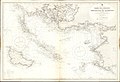 Admiralty Chart No 2353 Rade de Croisic to Presqu'Ile de Quiberon, Published 1895.jpg 16,228 × 11,120; 53.15 MB
-
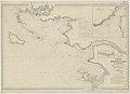
 Admiralty Chart No 2646 France west coast sheet 5 Bourgneuf to I. de Groix, Published 1858.jpg 12,274 × 8,384; 13.02 MB
-
 Bangor 56 opentopomap.png 1,850 × 1,023; 2.11 MB
-
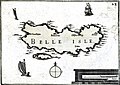 Belle isle Tassin 16011.jpg 3,245 × 2,294; 6.04 MB
-
 Belle-Ile en mer - btv1b84587040.jpg 7,208 × 5,566; 4.57 MB
-
 Belle-ile on nasa map.jpg 403 × 388; 47 KB
-
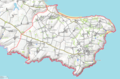
 Belle-Île-en-Mer administrative map-fr.png 1,118 × 878; 558 KB
-
 Belle-Île-en-Mer administrative map-fr.svg 1,118 × 878; 1.16 MB
-
 Belle-Île-en-Mer blank map.png 1,118 × 878; 304 KB
-
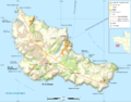
 Belle-Île-en-Mer satellite.png 1,000 × 1,000; 571 KB
-
 Belle-Île-en-Mer topographic map-fr.png 1,118 × 878; 604 KB
-
 Belle-Île-en-Mer topographic map-fr.svg 1,118 × 878; 1.38 MB
-
 Belle-Île-en-mer.png 994 × 724; 1.29 MB
-
 Bretagne contours mor braz.jpg 92 × 62; 3 KB
-
 Carte belleile.gif 1,346 × 1,140; 57 KB
-
 Carte d'État-major de la France, Feuille Belle-Île S.E.jpg 23,150 × 13,899; 65.25 MB
-
 Carte d'État-major de la France, Feuille Quiberon S.O.jpg 24,354 × 14,355; 71.39 MB
-

-
 Citadelle de Belle Isle et environs - btv1b53153322x.jpg 5,516 × 4,328; 3.14 MB
-
 Côte Sud Morbihan - Baie de Quiberon.png 418 × 452; 134 KB
-
-
 Le palais opentopomap.png 1,673 × 1,201; 2.01 MB
-
 Locmaria opentopomap.png 1,683 × 1,106; 1.72 MB
-
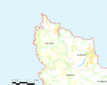
 Map commune FR insee code 56009.png 756 × 605; 44 KB
-
 Map commune FR insee code 56114.png 756 × 605; 31 KB
-
 Map commune FR insee code 56152.png 756 × 605; 46 KB
-
 Map commune FR insee code 56241.png 756 × 605; 41 KB
-

-
 Plans des ports de France (1777) - Bell'Isle.jpg 6,278 × 4,605; 2.91 MB
-
 Plans des ports de France (1777) - Le Palais.jpg 6,248 × 4,560; 3.04 MB
-

-
 Sauzon opentopomap.png 1,580 × 1,518; 1.97 MB

%27_(11167704496).jpg)


_-_Bell%27Isle.jpg)
_-_Le_Palais.jpg)
_Les_Forces_de_l%27Europe,_Asie,_Afrique_et_Amerique,_ou_description_des_principales_villes_avec_leurs_fort,_RP-P-OB-83.034-230.jpg)
